Blog

Cycling the Carretera Austral

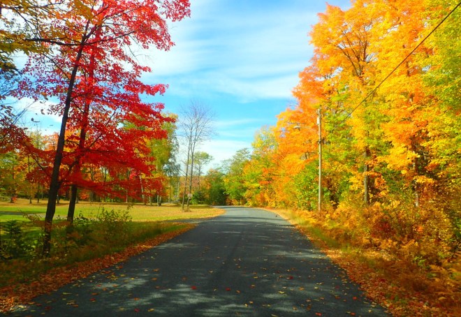
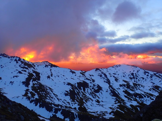
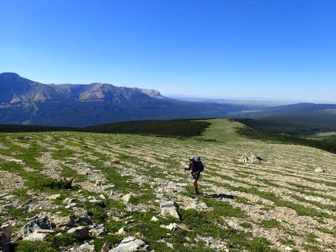
The Carreterra Austral is the southern-most section of road in Chile, approximately 1,200 kilometres of Highway 7, much of it unpaved and heavily corrugated. The brainchild of Chilean dictator Augusto Pinochet, construction of the road commenced in 1976, finishing 14 years later. Pinochet felt the CA to be a testament to his power to create such a difficult road through a jigsaw puzzle of alpine mountain ranges, yawning fjords, and rugged forest-lined valleys. The road was designed to link towns where no town should probably ever exist – with no connection to the outside world and few natural advantages – they only had one real advantage: they were strategically located to prevent Argentina from claiming the land.

The CA has become something of a pilgrimage for cycle tourists – who come especially, we were told to our amazement, to ride the route before it is fully paved.

Starting Out – Chaiten to La Junta (2 days, 165km, 2,800m uphill)

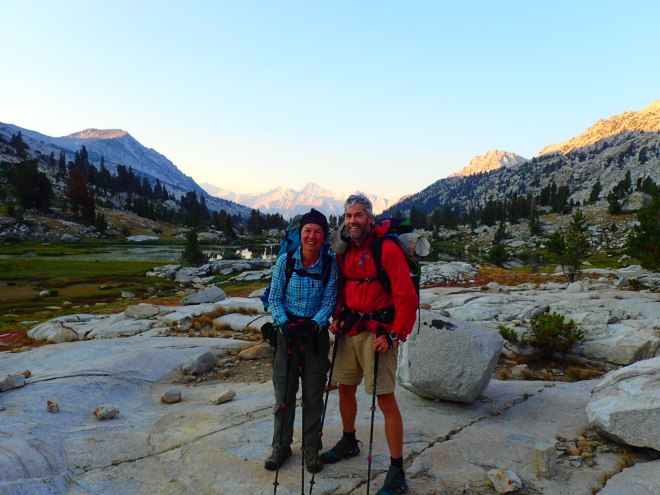
Bleary eyed, we wrestled our rented bikes off the overnight ferry from Puerto Montt to Chaiten along with a handful of other cycle tourers. Our panniers were weighed down with about eight days worth of food that we’d brought down from Canada in anticipation of highly limited options in the small towns along the way, but as we struggled to get forward momentum even on paved, flat surfaces and looked at the elevation profile for the day, lentils and rice for three-weeks straight suddenly seemed much more appealing…

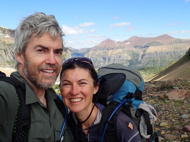
We had met Jens, a Norwegian hand surgeon, at our hostel in Puerto Montt the previous evening as we were all putting our bikes together for the ride, and immediately clicked with his enthusiasm and good sense of humour. We then met Jessica, a keen bike-tourer from San Francisco, as we were leaving the ferry. She was keen to join our small posse too, so the four of us set off together under bright sunshine, the (mercifully) flat road flanked with forested mountains.

After an hour of easy cycling, the road began to climb and after 50km we reached the gravel. It would be several days before we would see asphalt again. The steep elevation profile of the road, combined with the loose gravel, corrugations and our heavy bikes was punishing. If you skidded out in the gravel and put your foot down, you couldn’t get started again. So, for much of the next 12 or so kilometers, we were pushing our bikes on foot as we sweated and swore our way up the never-ending hill.

Despite rain being forecast the following day, the clouds did little more than threaten. Our ragtag ensemble grew as we joined a couple of Swedish cyclists, Stella and Wilfried, and their German friend Sebastian.

Although we were hampered by several punctures to Angie’s bike and several screws falling off Jonno’s, we made steady progress south, navigating a series of muddy road works to arrive at the township of La Junta late in the afternoon. Ravenous, we stocked up on alfajores and other goodies from a bakery near the main plaza and enjoyed a beer at La Casa de Te with Jens and Jessica, before rejoining Stella, Wilfried and Sebastian to cook dinner in the main plaza. As a group we decided to continue biking south , hoping to find a wild campsite along the way. No sooner had we left the sanctuary of La Junta than the skies opened up – at first a faint drizzle but slowly growing stronger. By dusk we had travelled 20km south of La Junta and reached a private campsite. Lured in by the promise of hot showers we negotiated hard for a spot for the night. By then the rain was bucketing down, and we were grateful for the warmth of a roaring fire and some dry shelter.


Wet, wet, wet – La Junta to Coyhaique (3.5 days, 277km, 4,800m uphill)

The following morning was grey cloud and drizzle. Nevertheless we were starting to get into our groove and made good progress on hilly terrain.

By the time we arrived at the village of Puyuhuapi at noon we were hungry. Clad in sweaty, mud-splattered cycling attire we settled down to a plate of delicious kuchen at the rather upmarket Hospedaje Alemania. As we sat around the fireplace warming ourselves with hot chocolate the cold drizzle persisted outside. Enthusiasm for continuing was, not unsurprisingly, low. Eventually our ambition overcame our procrastination and we cycled out of town about 4pm.

The road leading south from Puyuhuapi was a veritable construction site – heavy earthmoving equipment slowed our progress as we navigated our way around muddy potholes and trenches. About 25km from Puyuhuapi we finally selected a roadside site to wild camp. It was a raised patch of grass on the edge of a lake, and protected from the strong westerly wind.

OLYMPUS DIGITAL CAMERA
Roadworks, gravel and mud out of Puyuhuapi

After dinner we settled into what had become our routine of listening to a podcast. Following the podcast Jonno unzipped the tent and was surprised to see his and Angie’s shoes wobbling. Rubbing his eyes, his brain cells in overdrive, he noticed bags and other things bobbing about in front of him. A few seconds later he came to a startling realization…”We’re under water!” he yelled. Disbelieving grumbles followed.

What we had mistakenly thought was a lake had actually been a tidal fjord and the tide had come in fast – very fast. It was now 10cm up on the sides of the tent and rising at a rate of 2cm each minute!

Never has a campsite been dismantled so quickly. Within five minutes we had moved our bikes, tent and the rest of our gear to higher ground about 50m away. Fortunately for us we had managed to collect everything in time, and the waterproof underside of the tent had prevented a thorough soaking.

Jess had not been so lucky – a hole in her tent meant that it was soaked, along with many of her belongings, and one of her bike shoes had floated away in the flood frenzy. Angie’s notes from that day read simply “Beside lake windy and exposed. Previous campsites shit. Got flooded and had to move!!”

We woke early the following day, mindful of the steep climb ahead of us. By 9am we had set off into the mountains under an overcast, drizzly sky. The morning consisted of riding a lumpy, occasionally washed out road alongside the Quelat river, and was punctuated by several bike mishaps, from screws falling off to panniers falling off, as we bumped along the ripio. And I found a lone shoe lying in the middle of the road – size 7.5, right foot – which Jess was most grateful for.

OLYMPUS DIGITAL CAMERA

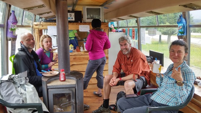
Late in the morning we switched into granny gear to begin a steady, switch-backed climb of 500m to a high pass carved into the cloudforest. It was slow, cold and gruelling work in the rain. After an hour or two we eventually crested the range and rattled downhill at a frightening speed all the way to the pretty village of Amengual, arriving at the town’s ‘sandwich bus’ in late afternoon sunshine.

unnamed (8)
Lunch on the sandwich bus

We set off from Villa Amengual after a relaxed breakfast, with sealed road and a gentle downhill most of the way until our salubrious lunch spot at the Copec petrol station, 58km later at Villa Manihuales. Manihuales is actually a cute little town with many supermarkets and some nice cafes, but our group-think mentality overcame common sense and we nonetheless dined beside the petrol bowsers with a killer view of all the cars coming and going.

IMG_0606.JPG

We set off again after lunch and were treated to epic views of rivers and mountains as we rode on for another 56km through the afternoon.

DSC_0905 copy.jpg

As the sun began to ride low in the sky we looked in earnest for a good campsite, finding what we thought was an excellent, hidden spot by the Rio Simpson in a seemingly disused CONAF reserve. We set out tents and pulled out our food and cookers, and just as we were nearly set to appease our rumbling stomachs, a ranger appeared and in very clear terms told us to move on. We quickly ate our food, repacked our tents and loaded the bikes, and in the darkness rode on several more kilometers to finally find a CONAF campsite where we could stay for the night.

We woke the next morning to the pouring rain and after waiting a couple of hours to see if it would pass, we decided to head out into it regardless. We soon hit a steep uphill, the road grinding its way through a nerve-wracking tunnel that we shared with several large lorries and not much shoulder room. The hill climb seemed to keep going and going, around numerous bends and up teasing false summits. Finally, we hit the downhill and coasted into the large town of Coyhaique with enormous relief. Just before lunchtime we rolled into the Patagonia Hostel, where Jonno had stayed after his Ice Cap Crossing expedition (and ever since had not been able to stop thinking about the mountain of pancakes drenched in real maple syrup). We stripped off our sodden clothes and tried to thaw out our frozen fingers and toes in hot showers. Angie swore she wouldn’t pedal one meter more until she’d found some thermal covers for her cycling shoes.

We enjoyed a great lunch and afternoon in Coyhaique with the sun coming out, as we gorged ourselves on cake, good coffee and a fresh salmon dinner that evening.

Time for some R&R – Coyhaique to Puerto Rio Tranquilo (2.5 days, 210km, 4,500m uphill)

We left Coyhaique on a sealed road in bright sunshine, and for a couple of hours enjoyed the easiest riding to date. Like riding a rollercoaster we zoomed up and down the low gradient hills, easily doing 20km per hour. Then followed several hours of sluggish grinding up the Ruta 7 to the head of a valley surrounded by the picturesque Parque Nacional Cerro Castillo.

The final half hour of the day was a real highlight – perhaps the highlight of the entire CA. A beautifully crafted road (whoever knew there was such a thing) slithered down a valley nestled amidst cloud-draped mountains. The smooth downhill gradient and gentle curves of the road allowed the kilometres to fly by. At one point we covered 8km in about 10 minutes – a far cry from earlier in the afternoon. After 100km – some hard and some easy – we arrived at Villa CC on dusk and settled on a ramshackle private campsite, where we soon had a wood fire going and a bowl of lentil soup in our hands (except for Jens who continued his habit of eating cereal and milk for most meals).

DSC_0806 copy 2.jpeg

Our eighth day of riding, from Villa CC to the head of Rio Murta, proved to be our most challenging day yet.

Immediately upon leaving Villa CC we were confronted with very testing road conditions. The paved road had ended (we would be riding on gravel for the remainder of our ride) and within half an hour we were struggling up steep, corrugated ripio much worse than we had encountered before. Reaching a crest Jens and Jonno stopped next to a couple of female British cyclists who were less than amused that it had taken them 23 minutes to cover the previous 2km.

OLYMPUS DIGITAL CAMERA

We spent the remainder of the morning and early afternoon pedalling hard along the Ibanez valley, dominated by a stiff headwind. Making less than 10km per hour facing into the dusty westerly was soul-destroying stuff, and we were pleased to finally turn the corner and head south alongside the Rio Cajon.

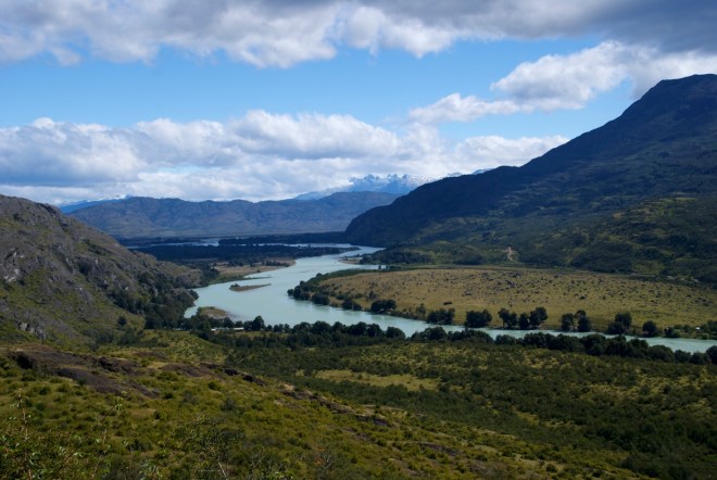
Exhausted, we ground our way slowly up the ripio toward the head of the Cajon valley, finally reaching a wild campsite as the road began to flatten out. We had reached the plateau between the Cajon and Murta valleys and were grateful that the following morning’s short ride mostly consisted of coasting downhill alongside the brilliant turquoise of Lago General Carrera, all the way to Puerto Rio Tranquilo.

DSC_0807 copy 2

At Rio Tranquilo we allowed ourselves a ‘¾ rest day’, and booked onto a tour of the Marble Caves. They were fascinating and beautiful. At the local cerveceria we also enjoyed some of the best craft beer anywhere.


The real Wild West – Puerto Rio Tranquilo to Cochrane (2 days, 150km, 3,000m uphill)

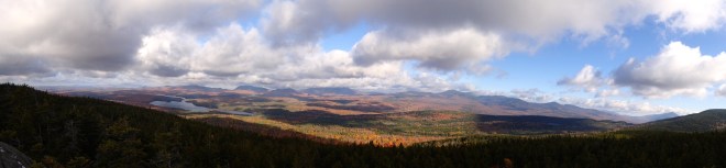
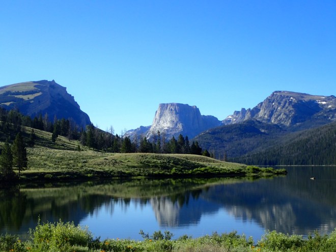
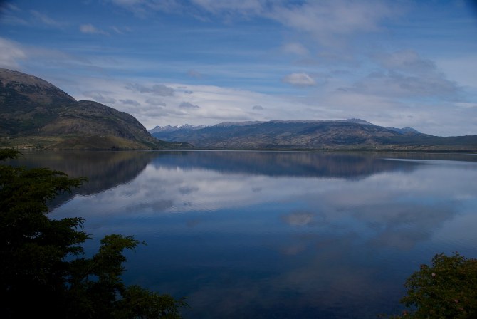
The jagged snow capped peaks on the eastern side of the Patagonian ice cap dominated the valleys to the south of Rio Tranquilo. The landscape was much drier and sunnier than we had experienced previously on our journey, the constant rain and drizzle of our first five days a distant memory.

Here, abutting the dusty carretera, the lakes and rivers were emerald and jade, turquoise and sapphire. Things had changed. The traffic was far less, the sense of wilderness much greater, and the scenery the most impressive yet.

DSC_0812 copy 2

Just before dusk we entered the picturesque hamlet of Puerto Bertrand, arriving immediately afterward at undoubtedly the best campsite to date – a beautiful cleared site in the forest alongside the cobalt blue rapids of the upper Rio Baker. A couple of Belgian cyclists, Wim and Ramon (who has began their ride in Lima some months before) had already set up camp, so our crew joined them in front of a great log fire for some convivial conversation over a few glasses of château cardboard.

DSC_0889 river.jpg

We continued to follow the Rio Baker the following morning, past a number of cabanas and great wild campsites. Why were there no other tourists on such a beautiful stretch of river?

DSC_0901 copy 2.jpeg

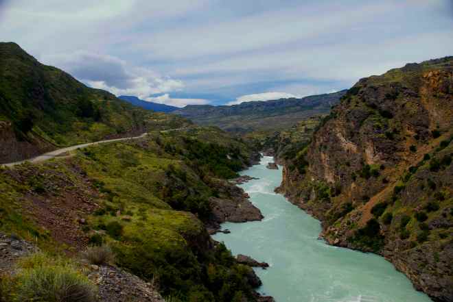
The confluence of Rio Baker with the Rio Nef is an impressive site – just below is a narrow canyon of churning water fierce enough to scare the boldest of whitewater addicts.

DSC_0907 copy.jpg

In the afternoon a ‘shortcut’ became a major detour, with a long, gruelling climb (under an even more gruelling sun) being followed by a hair-raising descent on a newly graded stretch of gravel. We woke the ferry master up from his afternoon siesta to convey us across Balseo Baker, and within an hour we had arrived in the frontier town of Cochrane (it felt like real cowboy country) keeping an eye out for a good saloon with cold beer.

Jens, Jessica and us enjoyed pizzas in town, while Stella and Wilfried, Wim and Ramon opted to wild camp further down the road.

The home straight – Cochrane to Villa O’Higgins via Caleta Tortel (4 days, 275km, 4,700m uphill)

After a morning spent foraging raspberries and cherries from the backyards of Cochrane locals, we followed the meander of the Rio de los Nadis, cycling through pleasant rolling countryside interspersed with dark, cool forest. We camped on the banks of the mighty river.

Although flat and straight, the road was shockingly corrugated from the Puerto Yungay junction to Tortel, with Jonno acquiring his first puncture of the trip. Quickly fixed, we continued our 22km ass-pounding to Tortel.

DSC_0928 .jpg

Caleta Tortel is a cluster of houses squeezed into an alcove on the edge of the Baker Channel, linked together by a series of boardwalks. There are many, many stairs.

After an hour of huffing and puffing we found ourselves a cabana for four, and cooked up as finer meal as we could put together from the supplies squished into our panniers. And plenty more châteaux cardboard. At Tortel we farewelled our friends Jens and Jessica. They had decided to spend their first proper rest day of the trip in Tortel, while we continued on to Puerto Yungay (where we had to catch a ferry) and then on to Villa O’Higgins.

The following morning we managed to hitch a ride 15km back to the Yungay junction, before spending a couple of hours on another ‘gravel roller coaster’. After two weeks on our saddles the riding had become much easier. We arrived at Puerto Yungay literally seconds before the infrequent ferry departed, clouds now blotting out the sky and rain beginning to fall heavily. Wim and Ramon had arrived there two hours ahead of us. We huddled inside the ferry cabin drinking cups of tea and eating biscuits with the Belgians as the rain poured down outside.

The remainder of the afternoon ebbed away in a shelter set up for waiting ferry passengers. Outside it rained cats and dogs. Needless to say, our plans of cycling an extra 50km were soon discarded and we spent the night in the shelter enjoying the company of the Belgians, three other cyclists, and part of a family of five that had missed the last ferry of the day. It was cosy.

IMG_0816

On our fifteenth day we were finally on the home straight – well, on the home run as the road could hardly be called straight. Snaking its way through the valleys and mountains, climbing and dropping steeply numerous times, it was a challenging ride of 101km for exhausted legs. Gasping for air after the steepest of the climbs, eagles soared in thermals high above us. With the weather holding and the finish line in sight, we pedalled strongly across the windswept mouth of Lago Cisnes and into the township of Villa O’Higgins. After nearly 1,200km this was the end of the line. We found beds in a wonderful hostel, El Mosco, and spent some time relaxing, socialising with other cyclists, and pondering how we might retrace our way back to Puerto Montt.

100 Miles of Wilderness

With the summer warmth fading we decided we’d make one last hike for the season to take advantage of the leaves changing colour in fall. We decided to tackle the ‘100 Mile Wilderness’ – a hike spanning the final 100 miles of the famed Appalachian Trail (AT), and what many regard as the finest and most remote section of the entire AT.

This involved driving over 4,000 kilometres from Arizona’s Grand Canyon to the trailhead in northern Maine – with this epic distance of what felt like non-stop driving for 4 days giving us pause to think that the AT hikers had walked nearly this same distance: 3,500km.

As we drove through New England, we feasted our eyes on the incredible palette of reds, pinks, oranges and yellows that blanketed the landscape around us. Every twist and turn of the road seemed to bring an explosion of colour that outdid the last.

OLYMPUS DIGITAL CAMERA
Glorious colours of peak foliage on the drive to Monson, Maine

Day 1: Abol bridge – Hurd Brook Lean-To (3.5 miles)

We had arranged to leave our van with Phil, the owner of the 100 Mile Wilderness Camp in Monson, and to pay him to shuttle us up to Abol Bridge where we planned to start (contact details for Phil below). Phil showed us around the cabins that he was in the process of fixing up – we had tentatively booked to stay there when we got back from the hike, but the lack of rain in Maine (ha!) had depleted his water reserves, so we quietly decided that we might look further afield for somewhere offering hot showers…

After lunch and a repack of our bags, we were bundled into Phil’s car for the 2-hour drive up north, with a quick stop off to check out a dam across the Penobscot River – famed for white water rafting. Phil gave us a load of tips for the trail, and regaled us with tales of his bodybuilding, weightlifting and hiking prowess as we went – and told us we were lucky to have caught the tail end of ‘peak foliage’ (the first of our new leaf-based vocab) as the low rainfall had threatened to stifle the annual event.

We arrived at Abol Bridge around 5pm and set off immediately, as the days were getting increasingly short and we only had little more than an hour before dark.

We felt as though a royal carpet had been laid out for us across the path, with the fallen leaves forming a multi-coloured mosaic on the trail before us that made our brains tingle with delight. We reached the Hurd Brook Lean-to after dark, having walked the last half-hour with our dimly-lit headtorches (with Angie pining for her AyUp that she’d left back in Australia in preference for the very light-weight (in multiple senses) Petzl e-lite) to find a campfire already burning. There we met Daniel, the first of the AT through hikers we were to meet on the trail. We enjoyed a great night hearing about Daniel’s epic trip and grilling him on the best and hardest parts, and how he generated the grit to keep walking for 7 months straight.

OLYMPUS DIGITAL CAMERA
Hiking in on what felt like rose petal carpets

Day 2: Hurd Brook Lean-To – beyond Wadleigh Stream Lean-to (18 miles)

We woke to find that mice had eaten through our dry bag (that had, mind you, been suspended from the roof, with a plastic plate tied onto the rope halfway down so that the mice couldn’t just climb down the rope…), and helped itself to all our salted cashews…

OLYMPUS DIGITAL CAMERA
Not sure if this little guy had anything to do with the midnight feasting… (pretty sure the culprits were mice!)

We had a leisurely start, having breakfast at the shelter and starting walking around 9am. It was a pretty flat day of walking, although muddy a lot of the way with the famed slippery, wet roots to navigate. We rounded Rainbow Lake with a long and beautiful traverse and stopped for lunch on it’s shores, where we chatted to a couple of through-hikers, getting the low-down on life on the trail. One fellow had taken 10 months, and espoused the virtues of going slow – although admittedly, it sounded as though a large factor was that he would head to town for a resupply around every 4 days and would often stay a night or two with much imbibing taking place with fellow hikers. We found this to be a similar story with a few other AT hikers we met, although we certainly weren’t going to criticize as who knows how we would feel after hiking for so long!

OLYMPUS DIGITAL CAMERA
Such a divine feast of colours!

We continued past Nahmakanta Lake to just beyond the Wadleigh Stream Lean-to (where the stream that normally provided water was dry, thanks to the lack of rain) to a makeshift campsite on the shore of the Nahmakanta Lake. After a quick, chilly swim in the lake, we set up our tent just as it began to rain and get dark, and cooked a quick but tasty meal of cous-cous, TVP and rehydrated veg (our current staple…) before turning in.

Day 3: Beyond Wadleigh Stream Lean-to – Antler’s Campsite (13 miles)

We tag-teamed today with two American ladies who were out walking with their dog, walking past the well-equipped State Campsite on the southern shore of Nahmakanta Lake before heading over Potaywadjo Ridge. This has pretty minimal elevation gain, but still was a good puff to get up and over. We went past Pemadumcook Lake and the nearby lean-to, dodging through mud bogs and trying to not twist ankles on the slippery roots.

We arrived at Antler’s Campsite before 3pm, and Angie insisted on going ‘just for a look’, before proclaiming that it was so beautiful there, that we should pull up stumps and enjoy the views, serenity and a campfire there. The campsite is built on a narrow isthmus on the Lower Jo-Mary Lake, and surrounded on three sides by the water. The lake is large and pristine, with the orange and red trees ringing its far shores. We were ahead of our planned schedule by that point, and Jonno was admirably successful in suppressing his natural desire to go as far and hard as possible 🙂

OLYMPUS DIGITAL CAMERA
Sunset over Lower Mary-Jo Lake from Antler Campsite

We scoured the beach for driftwood and got a fire going, set up our tent, and tucked into a dinner of mashed potatoes with the standard TVP and veggies before an early night.

OLYMPUS DIGITAL CAMERA
Jonno manning the fire

Day 4: Antler’s Campsite – Logan Brook Lean-to (20 miles)

After the shorter day yesterday – and long night’s sleep, we got up early to set off.

Jonno – who’s blood sugar levels seem to be consistently stable no matter what he has or hasn’t eaten – started out immediately, planning to have breakfast after an hour or so, while Angie sat by the lake to enjoy the views over breakfast and get some fuel into her belly.

OLYMPUS DIGITAL CAMERA
Early morning sunrise from Antlers Campsite

We both really enjoyed the 1.5 hours of solo hiking in the morning and chance to collect thoughts and enjoy the beautiful views along the Cooper Brook, before meeting up at the Jo-Mary road crossing a few miles along.

From there, we started a steady eight miles of uphill towards Little Boardman Mountain (approx 2,000 feet high), before dropping back down to the Pleasant River. We then continued our ascent up White Cap Mountain with some very steep uphill sections and big steps up large rocks and tree roots. We stopped around 1250 feet short of the summit at the Logan Brook Lean-to before dark – and mindful of our first night’s experiences with the noisy and hungry mice, set our tent up nearby. We were soon met by Matt, a chatty New Yorker, who recounted tales of his adventures in the Adironack Mountains, before calling it a night.

Day 5: Logan Brook Lean-to – Chairback Gap Lean-to (17 miles)

We woke up early to find our legs stiff after the previous day’s exertions, and set off keen to summit White Cap Mountain (3,654 feet). After a little rock scrambling we reached the summit, and were treated to great views including Katahadin Mountain – the famed final summit for the AT hikers – to the north.

We then had three smaller peaks to summit that were each slightly lower than the last- Hay mountain (3,244 ft), West Peak (3,178 ft) and Gulf Hagas Mountain (2,683 ft) – followed by a steady descent to the West Branch of the Pleasant River.

OLYMPUS DIGITAL CAMERA

We stocked up on water here, having been told that the stream at our planned campsite at the Chairback Gap Lean-to was dry, and were soon ascending again, up the base of the Barren Mountain Chairback Range and over Chairback Mountain.

We had a short but steep descent down Chairback Mountain (2,219 feet), before reaching the Chairback Gap Lean-to just on dark. We found a crew of AT hikers there already, with a steady fire going, and despite their invitation to join them and sleep in the Lean-to, we found a little campsite for a tent just above them, finding this a generally warmer (and rodent-safe) option.

OLYMPUS DIGITAL CAMERA

We enjoyed a good yarn with the hikers that night, learning about the staple diet of the AT hiker: 2-minute ramen noodles, and HoneyBuns – a sickly-sounding sweet bun that crams nearly half a day’s calories into one of the supersize versions. Despite the monotony of our dinners, they were nutritious by comparison, and several of the hikers admitted to malnutrition after 8 months of focusing primarily on calories with limited fibre or vitamins. We also were given insights into life and lessons of the trail, including the bestowing of ‘trail names’ (the nickname you acquire early on and are stuck with for the duration of the AT) and the much frowned upon practice of ‘yellow-blazing’ (i.e. avoiding large sections of the trail’s ‘white blazes’ to instead hitch a lift and follow the ‘yellow blazes’ of the centre lines on roads), particularly when you’re not honest about having done so.

Day 5: Chairback Gap Lean-to – Wilson Brook (17 or so miles)

We were up and about early the next morning, with Jonno convincing Angie to hold off breakfasting until we’d walked a little distance, and started heading up towards our next objective – Columbus Mountain (2,326 ft). We found a small patch of sunshine in the forest to have some breakfast on the way, and then continued with the day’s many ups and downs over Third Mountain (2,061 ft), Fourth Mountain (2,383 ft), and finally the summit of Barren Mountain (2,670 ft). On Barren Mountain, we were treated to sunshine and fantastic 360-degree views, as we had a late lunch beneath the old fire tower and pondered how this was actually used in some relation to fires.

OLYMPUS DIGITAL CAMERA
Views from Barren Mountain

Having achieved the last of the major uphills (or so we thought…), we happily descended Barren Mountain, crossing the Wilson Brook (happily, what is normally a mid-calf fjord was now rock hoppable due to low water levels), and continued along it’s western bank before finding a beautiful campsite as the sun went down, just beyond the junction with a little creek.

We had a beautiful evening, serenaded by water rushing through the nearby rapids and crackles from our campfire.

Day 6: Wilson Brook– Monson (10-ish miles)

With a relatively short day ahead of us, we enjoyed breakfast with our priceless views of the river before us, before packing up and setting off. The trail had many more ups and downs than we had counted on, having optimistically ignored the much smaller bumps in the elevation profile on the map in comparison to Barren Mountain.

2016-10-19 02.27.00.jpg

Along the way, we met Dave, an 80-year old Yank who was on the cusp of finishing the AT trail with his dog, Howard, having taken 10 months. Like many folk hiking with dogs that we’ve met in the States, Howard wore a vest with saddle-pockets, so he could carry his own food – and in this case, also Dave’s water. Smart! We were so impressed and inspired, and certainly hope to be fit and able to take on such challenges when we’re Dave’s age!

Before we knew it, we had crossed a couple of streams and arrived at a carpark. We had realized by this point that our van was still another 4 miles on at the 100 Mile Wilderness Camp, but some lovely people doing a day-walk that we had met on the trail arrived back at the carpark soon after us, and offered us a lift back into Monson – and ended up driving us all the way to our van.

We were soon back in Monson at the Lakeside Pub, enjoying excellent meals (highly recommended!) and drying ourselves out, before heading around to Shaw’s Hiker’s Hostel were we were able to book a room for the night. Kim and Jarrod, who have taken over ownership of the hostel, were incredibly hospitable and we had a great night there chatting with them about their experiences of swapping conventional work and lives for the beauty of the wilderness and helping out hikers.

Tips:

Timing: We hiked from the 13-19th October, which was really the tail end of the season. It was chilly, but we were treated to the incredible foliage! Apparently it was even better a week earlier. Six days was plenty for the hike, especially as the first and last days were so short (less than 2 hours the first day, and about 4 on the last).

Camping: Our favourite campsite was Antler’s, try to stay there if you can manage it in your schedule! There are plenty of places to camp besides the lean-tos, Phil marked many of these for us on a map and it was super helpful. Make sure you double check on water availability from other hikers as you go. Take a solid dry-bag for your food, the mice will get into everything!

Shaw’s Hiker’s Hostel: This place was the bomb. Kim (Hippie Chick) and Jarrod (Poet) were so welcoming and friendly, and the hype about the hiker’s breakfast (from memory, $9, includes piles of blueberry pancakes, bacon, home fries, toast and eggs) is well warranted. They will drive you out to the start of the hike for $110 and have private rooms (for 2) for $60.

Phil from 100 Mile Wilderness Camp: You can also stay and/or camp with Phil, and he will shuttle you out for $125, and leave your car at his place. He was in the process of a lot of work there, so the cabins should be pretty good! His place is about an extra 3-4 mile walk from the end of the 100 Mile Wilderness, so be prepared to either hitch or do the extra leg.

Eating in Monson: The Lakeside Pub, in the centre of town, was bloody brilliant. Rebecca who owns and runs the place was an absolute treat and made everyone feel welcome, and the variety and quality of the food was exceptional.

A Grand Anniversary

There are some times in life, when it feels as though the universe is conspiring to make something happen – and there are times when it feels the opposite is true.

This was one of the latter times.

We were really looking forward to our second attempt at an off-the-beaten-path hike through the Grand Canyon that Jonno had pieced together. The plan was to drop into the dry Little Colorado River (LCR) canyon near a viewpoint on Navajo land and follow this north, then west for 1.5 days until we reached Blue Spring (and could get water), and then for about a day further still to the confluence with the Colorado River. From there, we would follow the Beamer trail west for a day, and then ascend the Tanner trail to climb out of the canyon.

We’d first attempted to do the hike right at the beginning of our US adventures in June, but a strongly voiced park ranger, who “could think of no place in hell I’d rather be at this time of year than down in that LCR canyon”, talked us out of it . Given that we were in the middle of what we later found out was a significant heat wave – and that we would have had to carry water for 1.5 days – that was probably good advice, although we were very disappointed at the time.

As we were looping back past Arizona again in October after flying back into LA from our friends’ Jen and Todd’s wedding in New Zealand, we booked permits to do the hike then. This timing coincided perfectly with when our great friend Chantel was coming to the US, and she was super keen to hike the Grand Canyon too!

2016-10-02 12.25.21.jpg
The view of the Grand Canyon from the south rim

Well, despite all this planning, it just seemed that this hike wasn’t to be.

Our flights from New Zealand over the US were delayed by 24 hours. Then we arrived to find that recent rains had turned the normally dry upper reaches of the LCR into a raging (virtually undrinkable, and also potentially unnavigable) chocolate milkshake. Nonetheless, we tried to scout the entry route into the LCR and while we were 90% sure that we’d found a good route down, it was very steep and sketchy – and probably not ascendable if it cliffed out in parts that we couldn’t see. Still not fully dissuaded, we went to see about Navajo permits – and turns out they’d shut the office early and wouldn’t reopen for 3 more days. In a last ditch effort, we went to the Parks office to discuss options for going in anyway and seeking permits retrospectively – but were strongly advised not to…

OLYMPUS DIGITAL CAMERA
Trying to scout a route down into the Little Colorado River


So we looked for a Plan B.

Soon, we had our permits for what turned out to be a wonderful alternative – a return trip down the Tanner and northeast along the Beamer to the confluence with the LCR. Given that the normally breathtaking Blue Spring (a real feature of our initial hiking plan) had certainly lost its trademark colour and clarity anyway, it seemed like a pretty good option.

Day 1 – Down the Tanner Trail

After a great night of free camping on some BLM land near the Grand Canyon, we arrived at the Tanner trailhead at around 10am, after the usual amount of pre-hike packing, planning and pfaffing.

We were soon hopping our way down the steep switchbacks that lead into the canyon. We stopped for lunch about halfway into the canyon under the shade of a tree at a plateau, admiring the beautiful, muted red, orange and green hues of the canyon were all around us.

2016-10-03 08.27.26.jpg

It was another couple of hours before we reached the Colorado River at Tanner Beach – around 1400 metres below our starting point, over 14.5km. After a short break, we turned east and walked for another hour or so, to find a campsite near Palisades Creek, just under 5km from Tanner Beach. Our legs were tired from the steep descent for the day, and we pitched our tents on the hard sandy bank of the Colorado River for the night just before the sun set.

2016-10-03 10.04.10.jpg
Heading upstream on the Beamer Trail
2016-10-03 12.09.00.jpg
The view downstream from our campsite

Attention soon turned to the need for drinking water, with the Colorado full of mud. We filled all our bottles and cups to let the water sediment out, but fortuitously (and unsurprisingly), my patience for a cup of tea ran out and I tried boiling the turbid water hoping that the tea would disguise the mud – and found that the boiling caused rapid sedimentation of the water – a neat trick!

2016-10-03 12.22.43.jpg
Boiling and settling out the chocolate mud river water

Day 2 – The confluence with the LCR

2016-10-04 01.48.16.jpg
Heading out early the next morning on the Beamer

We woke early the next morning, keen to continue up the Colorado for around 10km to the confluence with the LCR and to explore as far beyond as we could. The trail took us around some very steep drop-offs that we preferred not to look out over – and offered incredible views up and down the canyon.

2016-10-04 02.30.53.jpg
Chan and Jonno testing out the edge of the canyon cliff

At the confluence, we could see that the muddy water was coming from the LCR – and that if we could just cross the LCR, we could then get much cleaner water from the Colorado upstream of the confluence. We spent 30 minutes trying to wade across, but the soft, sludgy bottom combined with the strong, deep flow of the LCR was too challenging.

So we resigned ourselves to another night of sedimentation, and went exploring up the LCR canyon, and quickly found a little shelter that was built into the rock side of the canyon by Ben Beamer, a miner who had been living here around 100 years ago who is credited for having constructed the Beamer trail (hence it’s name), which most likely followed older Hopi Indian trails.

PA040081.JPG
Jonno outside Ben Beamer’s hut

We picked our way up and down the LCR canyon a little more, before returning to the confluence for an early lunch.

We were sitting beside some salt pools, which the ranger had explained to us were part of a still going initiation rite for the Navajo and Hopi Indian tribes. Youths must find their way down into the canyon, collect a bag of salt from the bank of the river, and return back to their tribe with it – a trip that would often take weeks.

We found an even better campsite that evening, nestled in amongst the trees and well protected from the wind, and soon had our tents set up and were ready to celebrate our one year wedding anniversary! Jonno had carried a bottle of anniversary wine that our friends’ Cheryl and Alex had given us over from Australia and all the way down into the canyon. Only when we went to open it, did we realise that it was an old-school corked bottle and we didn’t have a corkscrew! But then, who needs one when you have hiking poles?

Day 3 – Up, up, up and out again

On our final day, we started early to get as much shade as possible and retraced our steps back along the Beamer, and up on the Tanner. Those 1400 metres felt a lot harder on our thighs and glutes, and we were glad to reach the top by mid-afternoon and headed off in search of a shandy!

Honeymoon hiking on the Travers-Sabine

On a previous trip to New Zealand in 2014, Jonno and I hiked (with some packrafting by Jonno) the Travers-Sabine circuit near St Anaud in the Nelson Region, at the northern end of the South Island.

It was one of the best hikes we’d ever done. Epic views, ridgeline walking, some hefty uphills and a little scrambling, beautiful river valleys… it really had it all. And best of all, the surrounding area was dotted with little huts, offering countless opportunities to explore and create a new itinerary. In particular, Angelus Hut – perched up high near a long ridgeline, sitting astride the beautiful Lake Angelus – was absolutely stunning, and Jonno immediately saw the potential for a winter snowshoeing trip there for a whole new kind of adventure.

So, when Jen and Todd invited us to their wedding in Kairoura, New Zealand in September – and mentioned that they were keen for a hiking trip with the crew of adventurous buddies who would be in attendance, we knew just the hike to suggest!

We were indeed a honeymooning bunch! Jen and Todd were still glowing from their wonderful wedding a few days ago, Tim and Martina were fresh from their Croatian nuptials a week earlier, and we were in the middle of our year-long extended honeymoon travels! We hoped all the love vibes might convince Jon and Jude to finally throw a big bash of their own (although they’ve held out for around ten years so far!), and Mike is as always insightful and generous with his reflections on love and life!

2016-09-22 13.11.33.jpg
The newly weds heading up Robert Ridge

Day 1 – Up to Angelus Hut

We were finally parked at trailhead to Robert Ridge by 11:00am just outside St Anaud, after a detour past the DOC office to leave bags in safe storage and pick up hut tickets. Jude had broken her toe at Jen and Todd’s wedding, so they had headed off a little ahead of us all to get a headstart, and we planned to all meet for lunch at the shelter on Robert Ridge.

2016-09-22 12.42.55.jpg
Heading up the switchbacks to Robert Ridge

The climb up from the carpark is a steady set up of uphill switchbacks, and we were all feeling the indulgences of the last week! After an hour or so, we spotted Jon and Jude, who’d already broken for lunch. They were happy to pack up and keep going with us all a little further, and we soon reached the shelter. After windy lunch, we continued along the ridgeline with eyes on the clouds around us.

Robert Ridge was a little scrambly at times, with the snow covering the path in places and we alternated between picking our way through the rocks and walking on the firm snow.

Before we knew it, the sky began to turn pink, and we became surrounded by the most majestic sunset over the mountains around us.

2016-09-22 17.30.35.jpg
Sunset from Robert Ridge

By this stage, everyone had realised that Jonno’s predictions of how far the hut was weren’t to be trusted, so we kept walking with headlights as it grew dark around us, paying careful attention to the trail markers around us.

After controlled slides down a steep, snowed over hill, we arrived at Angelus Hut to find the fire going and another couple keeping Mike (who had beaten us there) company. It was Jude’s birthday, so as soon as we had changed clothes and gotten warm, we set to the business of celebrations, dinner, birthday cake and dutch stroopwafels – and a beautiful evening of laughing and swapping stories and philosophies of life, love and adventures.

Day 2 – Exploring the surrounds

We woke up leisurely to some yoga and coffee, before strapping on our snowshoes and heading out to explore the area around Angelus Hut. Jon and Jude opted to stay behind to give Jude’s toe a rest, and waved us off as we headed southwards, up onto the ridge in front of the Hut.

2016-09-23 10.10.29.jpg
Heading out to explore on snowhoes

We ascended and then traversed along below the ridgeline with ease, however some very steep – and sketchy – sections were required in order to reach the ridgeline proper above us – with Jonno and Todd out ahead cutting steps while the rest of us watched and followed.

2016-09-23 11.27.23.jpg
Jonno cuts steps up to the ridgeline

We had an early lunch admiring the views, and Todd and Martina’s acro-yoga, before realising that we would actually have time to scramble up Mt Angelus, which was standing tall just behind us.

2016-09-23 12.05.33.jpg
Todd and Martina showing us how it’s done

Tim and Martina decided to head back to the Hut a little earlier, and as they didn’t have snowshoes, took the fast route down the snow slopes and blazed off into the distance.

2016-09-23 10.23.38.jpg
Tim and Martina take the fast route down

The rest of us scrambled around on the rocks to the base of the scree field leading up to the summit. We dropped our packs, and puffed our way up through the slippery scree. After about half an hour, we found ourselves on the snow with just a short burst up to reach the summit. We were well rewarded with panoramic views of the mountains around!

2016-09-23 13.48.26.jpg
On the top of Mt Angelus

We scree-skiied our way back down to our packs, and then set off in Tim and Martina’s foot (and bum-sliding) prints. It was a relatively easy traverse around to the west and back towards the Hut, where Mike stopped for a swim in an open section of the otherwise frozen in lake – the rest of us watched and shivered in amazement (it turned out that Tim had done the same just a short time before!).

2016-09-23 13.57.38.jpg
Heading down from Mt. Angelus


Day 3 – down to Sabine Hut

We woke up early keen to make a good start, hoping to reach Speargrass Hut so that our final day would be a short one.

We reached the treeline under the snow by lunchtime, and had a break to eat here fore heading on. Once within the trees, there was a lot of scrambling over fallen trees and wet roots, which slowed progress substantially. The clouds overhead were darkening, and by the time we reached Sabine Hut it was raining. We decided to pull up for the day and brave the notorious sandflies that plagued this particular hut – and all dived into Lake Rotoroa for a swim before hitting the tea and snacks.

2016-09-24 10.03.11.jpg
Traversing around to the west towards Sabine Hut from Angelus Hut

Day 4 – fallen trees and missing water taxis

We woke early the next day, as we needed to cover a lot of ground in order to be sure to get back to our cars and to the DOC office before it shut to collect our bags.

We set off in the drizzling rain, and within metres were faced with a thick tangle of fallen trees. As we wove over, under and through the trees and thick undergrowth, slipping on wet roots and mud, we realised that this could take much, much longer than we had anticipated. Jude’s toe was certainly feeling the strain, and she and Jon decided to head back to the Hut to see if they could call a water taxi to come and collect them.

The rest of continued on with our slow progress, losing the trail at times, and were greatly relieved when around 1.5 hours out from the hut, the trail became clearer and we could stretch out our strides.

We continued on and crossed a swollen river with a variety of techniques, reaching Speargrass Hut for lunch. We realised that we were making good time despite the morning’s delay, and powered on in the afternoon to reach the carpark by 3pm. We picked up all the vans, and headed over to the DOC office to collect our bags – expecting to see Jon and Jude waiting there for us… but no luck!

After a few phone calls, the DOC officer informed us that someone had indeed tried to call the water taxi, but hadn’t been able to connect through. We realised then that Jon and Jude would likely try to walk out with Jude’s broken toe. They might make it to Speargrass Hut and stay overnight, or they might get all the way out that same day. With no way to contact them, all we could do was return their van to the trailhead, hike the keys for them, leave a note to let them know where we were and hope that all would work out!

Sure enough, we had all no sooner settled in to the Alpine Lodge and showered, when they walked through the door – having made excellent time with Jude powering on with her usual, indefatigable style! It was a great hike, with wonderful friends, and one we’d certainly recommend!


Tackling the High Sierra

The Sierra High Route was first conceived by leading Californian climber and outdoorsman Steve Roper in 1977. His book – which we haven’t read, but probably should have – describes a route through the Sierra mountains that stays as high as possible, rarely dipping below 10,000 feet in elevation, while visiting some of the most spectacular, iconic settings of the high alpine regions of the Sierra Nevada mountain range.

The route consists of about 210 miles (340km) of on- and off-trail hiking, crossing 33 high alpine passes and running from north to south across the heart of the Sierras, through Sequoia-Kings Canyon National Park, John Muir Wilderness, Ansel Adams Wilderness, and Yosemite National Park.

It has been variously described as “brutal”, “the hardest hike in America”, “a remote trek and a route finder’s dream”, and “a rugged alternate to the John Muir Trail (JMT)”. As a result we had thought long and hard about this trip, and whether we should instead stick to the immensely popular, and well marked JMT. In the end, the SHR won out for two main reasons: challenge and solitude. Armed with a mapset and compass we set off with strong legs, an enthusiastic spirit…and heavy packs.

We’re pleased to report that we completed the route in 13 days, with one resupply along the way. Over the 340km route, we ascended over 18km, and the same again of descent. That’s a lot of up and down – the equivalent of climbing Mt. Everest from sea level twice – much of it off-trail and over talus and scree.

Day 0 – Roads End to Grouse Lake (nearly)

Most of today was spent racing towards our starting point, Roads End in Kings Canyon. Despite encountering a succession of ‘Sunday drivers’ and several road closures (to repair bushfire damage), Bryan, our Fresno-based driver, was doing everything in his power to deliver us to the Road’s End ranger station before it closed at the unusually early time of 3.30pm so that we could collect our permit.

We arrived at 3.20. Ranger Sailor scribbled some indecipherable information onto our permit, signed it and we were off. We immediately began slogging it up the Copper Creek trail – sweating under the weight of 8 days food (hopefully enough to get us to our resupply) as we clawed our way up 1,700 m of graveled elevation gain to reach our first evening’s camp just after dark, just shy of Grouse Lake.

Day 1 – Grouse Lake to Marion Lake

The day started well with a short hike to have breakfast overlooking Grouse Lake, followed by a couple of hours following vaguely forested trails into the more exposed rocky outcrops of the high Sierra.

2016-08-21 02.42.48.jpg

By mid-morning our shoulders were aching, by mid-afternoon we were contemplating whether our insurance would cover knee replacements.

We followed our nose to Grouse Pass, Goat Crest Saddle and Gray Pass, which we managed without too much trouble. White Pass was a different matter. A long, steep ascent up a pine dotted mountainside, hopping across splashes of granite, took us several hours – and constant map checking – in the afternoon heat.

2016-08-21 09.34.32.jpg

We weaved left and right as we slowly fought our way up the hill, that seemed relentless. Finally, near the top, we were rewarded with a view of the pass – no more than a mile away – and put our heads down to grind up to the top. Both of us had tired legs, but marched on thinking about the downhill on the other side – and deliberately not thinking about the several hours of daylight left that meant it was some time yet before we could kick out boots off for the day!

Cresting White Pass, our eyes ventured east – and not too far away we spied Red Pass. It was an enjoyable traverse of the rock slabs from White Pass to reach Red Pass, then, as dusk approached, a bone-rattling, knee-pounding descent to the turquoise of Marion Lake…

2016-08-21 12.13.16.jpg

We found a good tent site just above the lake, set up camp in the fading twilight, and enjoyed our first taste of couscous, dried vegetable and TVP surprise – little did we know that both the dinner and the day was to become typical of the days that followed.

By the end of the day Jonno was spent. “That is the toughest day of hiking I’ve done in a long time”, he said – one day down, only two weeks to go…

Day 2 – Marion Lake to Lower Palisade Lake

We woke early, breakfasted and started the day with far more spring in our step than the previous evening. With the sun still hiding behind the morning cloud we navigated our way around Marion Lake and up the stepped slopes of Lake Basin toward Frozen Lake Pass.

2016-08-22 04.48.52.jpg
A rare and much needed break in Lake Basin!

Locating Frozen Lake Pass was, for us, problematic. The terrain features didn’t marry with our map but we pressed on for 30 minutes regardless. We triple-checked our map and realised the error of our ways. Too far north and not far enough east. We scurried across a couple of gulleys and managed to regain the approach to the pass. We had lost an hour and we were both frustrated and annoyed. We needed a snack.

This was our first major DNF (Daily Navigational F…ailure). Similar such navigational hiccups were to become a feature of our first days on the trail and it wasn’t until day 7 that we were able to celebrate a daily where we had succeeded in getting the nav right for the entire day.

2016-08-22 05.43.17.jpg
Jonno descending from Frozen Lake Pass

Eventually we crested the steep rock. The sketchy descent down scree and talus from Frozen Lake Pass met with its sphincter-tightening reputation, and lasted well over an hour – broken by a lunch and swim intermission at a small glacial-fed lake that gave the pass its name.

OLYMPUS DIGITAL CAMERA
Jonno braves the water near the base of Frozen Lake Pass

By mid afternoon we had joined the John Muir Trail – a veritable superhighway – and were zig-zagging our way up the long switchbacks that led up to Mather Pass. After seeing nobody for the first couple of days on the High Route, we were a little overwhelmed to meet a dozen people in the first 30 minutes. The well-maintained trail up to Mather Pass, cut into the seemingly impossible face of the rock, was an engineering marvel – a series of long, low-angled switchbacks leading up through jumbled rock and scree to our second major pass of the day.

On our descent the storm clouds that had brewing all afternoon finally opened up. We continued walking for a couple of hours in the drizzly rain past numerous tents (their occupants firmly ensconced in book reading and tea drinking) until finally setting up camp alongside lower Palisade Lake. We had hoped to get over Cirque Pass that afternoon, but the rock looked to dangerous in the wet, so we agreed to head off early the next morning to try to make up time. Cirque Pass would again take us off trail, so while Angie cooked up couscous delight (again), Jonno scouted out a route up the rock face that stood impressively in front of us.

Day 3 – Lower Palisade Lake to Head of Kings River

We woke and packed early, planning to breakfast after we had climbed up the steep rocky slabs that led up to our first objective of the day – Cirque Pass. We reached a plateau with gorgeous views back down to the Palisade lakes, and up to the rock cirque that still sat above us, after an hour. We breakfasted by a little lake (noting that this could have been a great campsite!), and tried to work out the route to the Pass above us, through the steep series of rock slabs at the head of a hanging valley. It was very picturesque, even in the overcast morning light.

Soon we were scrambling up and over the rock slabs, with Angie scouting ahead on a potential route out to the far right. Unfortunately, she soon found herself stuck with a set of steep ledges and overhangs above her and no choice but to try to scramble back down, losing a lot of both energy and time. With a little more looking around, we found a few rock cairns, and managed to pull ourselves up to the pass with much relief.

From there we traversed across to Knapsack pass, and then dropped into the Dusy Basin from Knapsack Pass – it felt very remote. The terrain was the most rugged we had yet experienced, but the scale of the scenery was impressive… treeless, rock slabs and boulders hung from the jagged mountain ridges like an unkempt hipster’s beard. As far as the eye could see there was talus, talus and more talus…

By late afternoon we had wandered down into a treed valley to join up with the Bishop Pass Trail. Again it began raining. We descended a steep, switchbacked trail past water streaming down giant slabs of rock to arrive back at the JMT.

We had hoped to meander up the LeConte Canyon and cross Muir Pass today, but the DNF and the rainy weather curtailed our plans somewhat. We ended up camping in a wet, snowy campsite a couple of hours below the pass – much to Angie’s relief, with her legs aching and feeling right at her physical limits. We passed a number of JMT thru-hikers who shared stories of their afternoon anguish up on the pass. Apparently where we had experienced a bucketful of rain they had experienced a gale, with a thunderstorm and hail thrown in. “Terrifying” was how one hiker described it.

As we settled into our dry sleeping bags that evening we felt exhausted – and lucky.

Day 4 – Head of Kings River to Upper Wahoo Lake

Waking early, we quickly ascended the trail to Muir Pass through the most spectacular basin of sapphire blue lakes, reflecting perfectly the surrounding mountains, which were to become a feature of the day.

2016-08-24 03.44.05.jpg
Spectacular lakes en route up to Muir Pass

After a good snack break at the pass, we descended into Evolution Basin, the trail hugging the edge of a number of pristine alpine lakes – Wanda Lake, Sapphire Lake, and finally Evolution Lake. The sun was out and without a doubt it was the most incredible scenery we had witnessed so far.

OLYMPUS DIGITAL CAMERA

OLYMPUS DIGITAL CAMERA

We left the trail late in the morning to scramble up to Darwin Bench, aided by a few strategically placed rock cairns. We spent the following hours being frustrated by the navigational challenges imposed on us by the undulating terrain. We scrambled up, down and over endless trees, rock ledges, streams and thick brush, in contradiction to the notes we’d read that suggested the Bench provided an easy path. It was very challenging, physically and mentally. Eventually we broke out of the treeline to cross the swampy sections of a high plateau.

2016-08-24 06.36.56.jpg
Along the JMT through Evolution Basin, before heading up to Darwin Bench

Suddenly, the skies opened yet again and we found ourselves in the midst of a hailstorm. The hail was fierce, stinging our eyes and exposed skin. We huddled behind a stand of pines until the storm abated. Once the hail had slowed, we continued our ascent of the valley toward a small groove in the fearsomely corrugated ridgeline, Snow Tongue Pass. The sun eventually broke its way through the cloud cover to shower us in late afternoon alpenglow.

At Snow Tongue Pass we stared down into the abyss below. It was an extremely steep descent ahead of us – real sphincter-clenching stuff. “Probably Type 3 fun”, Jonno offered in jest. Then, after a minute or two of descent, the hail started again. “ Let’s revise that to Unfun.”[1]

2016-08-24 13.05.14.jpg
In between hail storms, Jonno picking his way down from Snow Tongue Pass

We slowly inched our way down the steep scree and loose talus, firmly thrusting our poles into any nooks and crannies we could find along the way. With the hail biting at us with every step, it was painfully slow going.We agreed on inventing new categories for describing the personality of the talus we encountered. ‘Friendly’ talus is large blocks firmly rooted in place, where one could hop from one rock to another without fear. “Unfriendly talus’ is the opposite – loose and unstable, often smaller, and ready to crush a limb at any moment.

By dusk we had picked our way down the car-sized rocks to Humphrey’s Basin and arrived at upper Wahoo Lake – with just enough moonlight for us to see each other we pitched the tent on the shore of the lake, before collapsing into bed absolutely exhausted.


2016-08-24 13.43.21.jpg
Sunset over Wahoo Lake as we skirted the shores to find a campsite

Day 5 – Upper Wahoo Lake to BearPaw Lake

The following morning we again woke at dawn and started off straight away. It promised to be another big day, with several more passes and some significant changes in elevation.

More talus greeted us as we made our way to Piute Pass. From there we made our way past Tomahawk Lake and Mesa Lake, then scrambled up a ramped series of rock benches to Puppet Pass, where we met the first people we’d seen in a day or two. They were doing a day trip from their camp. We rock-hopped quickly past them on the descent, now used to traversing the (in this case friendly) talus.

2016-08-25 05.21.07.jpg

A few hours later, scrambling down through forests of pine and mixed vegetation we joined the Pine Creek Pass Trail and descended into French Canyon, giant slabs of dolomite dominating the northern side of the valley.

We then scrambled northwards up a very steep trail that led through the forested dolomite slabs to Merriam Lake, continuing past the lake up a broad valley surrounded by jagged ridges of loose rock. Another steep scramble led us to La Salle Lake, and from there toward the impressive prominence of Feather Peak. It was tough work hiking up to Feather Pass amongst yet more haphazardly strewn talus – we celebrated the achievement with an early dinner at the Pass of soup, mashed potato and vegetables, and dark chocolate.

After gingerly descending from the pass on a giant field of talus we arrived at the damp, spongy shoreline of BearPaw Lake just on dusk. It had been yet another knee-grinding day and we were both relieved to tumble into our sleeping bags.

OLYMPUS DIGITAL CAMERA
Camping on the spongy BearPaw Lake shore

Day 6 – BearPaw Lake to Laurel Lake

We passed another couple of campers and an avid fisherman early the following morning as we bounded down the valley. Unfortunately we bounded a bit too far. We missed a critical NE turnoff up a rocky gully to Black Bear Lake – only when we arrived at Big Bear Lake did we realize our error. Within 30 minutes we were back on course, the annoyance of yet another DNF subsiding rapidly with the onset of a hearty breakfast.

2016-08-26 03.16.31.jpg

We traversed the rocky walls, slabs and blocks that surround White Bear, Brown Bear, and Teddy Bear lakes, slowly descending a vast valley under the watchful eye of the chiefly eminence of Granite Peak that led us toward Lake Italy. As Jonno was engaged in discussion with a solo hiker whilst re-filling his water bottle on the shore of Lake Italy, Angie led the way up a series of rocky, red slabs toward Gabbot Pass. The sun was out in force as we powered our way up and over the pass, the sweat cooling quickly on our bodies as we descended a steep pseudo-trail that dropped us into Mono Creek.

2016-08-26 06.57.09.jpg

From Mono Creek we continued northward up a steep switch-backed trail to Laurel Lake, where we found a great lakeside campsite in an amphitheatre surrounded by serrated ridges of red, white and silver rock.

Day 7 – Laurel Lake to Deer Lakes

Within 30 minutes of leaving camp the following morning we had made our way up to Bighorn Pass, a steep scramble up rock and grass slopes. We had taken to selecting ‘green ramps’ as our way up steeper slopes and gullies – figuring that if the grass could grow there then we should be able to climb it.

Some complicated navigation – which we managed without error – brought us to Shout of Relief Pass.

2016-08-27 03.13.09-3.jpg
Jumping for joy at Shout of Relief pass

Crossing the Silver Divide we descended into a basin of silvery lakes, before joining a use trail that allowed us to descend to Tully Hole and back up to the beautiful Lake Virginia where we lunched under a warm sun. A few other Pacific Crest Trail hikers had the same idea so we enjoyed a brief interlude chatting to them.

OLYMPUS DIGITAL CAMERA

In the afternoon we followed an easy, well-maintained trail to the spectacular Duck Lake, then left the trail in a westerly direction to skirt along the edge of the Mammoth Crest, a ridge with a very steep drop-off to the NE.

After all the up and down our legs were extremely tired. We had planned to have dinner at Deer Lake and then continue on another hour, but halfway through our meal it began to rain again, and so we were both secretly relieved to set up camp beside the scenic Deer Lakes just as the fiery sun began to set.

Day 8 – Deer Lakes to Superior Lake

Skirting along the edge of the Mammoth Crest to Mammoth Pass the following morning was one of the highlights of the trip. The views opened up around us – we soon saw signs of the human sprawl from the Mammoth township. We skied down a near-vertical slope of dust to reach Mammoth Pass, then wandered through a forest of charred, post-apocalyptic-like tree stumps (the result of fires way back in 1992) toward our one and only food resupply point at Reds Meadow.

OLYMPUS DIGITAL CAMERA
Never thought an ice-cream sandwich could taste so good

We stuffed our faces with ice cream, hamburgers, beer and chips at Red’s Meadow, had a much needed shower, washed our clothes and repacked, and listened to a number of PCT and JMT hikers regale us with their stories of how well they were managing (or not) on their respective trails. Around mid-afternoon we continued northward on a trail leading toward Superior Lake, dodging a sizeable contingent of tourists huddled around the Devils Postpile National Monument on the way.


2016-08-28 10.48.38.jpg
Devil’s Postpile National Monument – naturally formed columnar basalt that creates these enormous, spectacular columns

Day 9 – Superior Lake to Thousand Island Lake

Early the following morning we met a father-son duo intending to complete a section of the SHR – this was their first off-trail section, so they were keen to set out with us. Together we began a very steep scramble up to Nancy Pass, through dense, unpleasant vegetation. Sweat ran into our scratches. Our colleagues laboured under the weight of their packs, so once the rest of the route to the Pass was clear, we pushed on without them as we were mindful of the distance we still had to cover that day. It was the first time we’d met anyone hiking the SHR in the same direction as us and it was noticeable just how much ‘route fitness’ we had acquired over the previous week.

The view from Nancy Pass was impressive and well worth the scramble up! We dropped down into the Minaret Basin, traversed a number of rock ledges, then climbed up to turquoise blue Minaret Lake. We met a number of other hikers on shorter trips, who encouraged us to continue onward to Cecile Lake and Iceberg Lake. This series of lakes was one of the scenic highlights of the route so far.

The afternoon was spent scrambling up and down passes, and immersing ourselves in the solitude of the valleys in between. We pushed past Lake Ediza and over Whitebark Pass, before dropping our jaws at the sight of Garnet Lake, closely followed by Thousand Island Lake, our campsite for the night.

OLYMPUS DIGITAL CAMERA


Day 10 – Thousand Island Lake to Lyell Forks

Some very technical navigation took us to the first of the Twin Island Lakes. We scrambled along the ledges on the eastern side, after descending steeply from Glacier Lake. There was no semblance of a trail and the scrambling down the valley to Bench Canyon required some careful navigation and footwork.

OLYMPUS DIGITAL CAMERA


Under a hot afternoon sun we scampered up past the pristine Blue Lake and Blue Lake Pass to join the Isberg Pass Trail, which took us through pine forest, finally descending to our day’s rest at a makeshift campsite near Lewis Creek.

OLYMPUS DIGITAL CAMERA
Garnet Lake

Day 11 – Lyell Forks to Gaylor Lakes

This was our easiest day of hiking – we covered about 30 miles on well-worn trails. A slow grind brought us to Vogelsang Pass where we passed a couple of cowboys languorously guiding some heavily laden horses up the trail.

OLYMPUS DIGITAL CAMERA
Cowboys coming over Vogelsang Pass

We lunched and bathed at Vogelsang Lake before a long march took us to the well-known Tuolumne Meadows. Much to Angie’s disappointment we arrived a few minutes too late to catch the last bus to a café and shop a few miles down the road. Somewhat disheartened we settled for a riverside dinner of… couscous and vegetables (surprise!), before another couple of hours brought us to a mosquito-infested campsite near Gaylor lakes.

Day 12 – Gaylor Lakes to Shepherd Lake

OLYMPUS DIGITAL CAMERA
The ruins at the Great Sierra Mine

The sky was clear as we began our day hiking past the ruins of the Great Sierra Mine and then over gentle terrain toward the Conness Lakes. We traversed various rock outcrops under a warm sun, then roller-coasted over one pass after another. We lunched alongside an unnamed alpine lake, then clambered up the ridge to the north. We looked west to see a band of mountaineers being trained in crevasse rescue techniques on the lower reaches of the Conness Glacier.

OLYMPUS DIGITAL CAMERA
Nearly averted catastrophe: climbers attached by snow anchors, who were nearly wiped out by a falling boulder

Suddenly we heard loud cries of ‘ROCK!’. A giant block, perhaps the size of a small bus, had been dislodged by some other climbers further above and was pummelling down the steep glacier toward the trainee mountaineers. They were desperately straining to get out of the path of the falling slab, but were fastened to the spot by snow anchors they had hammered in for safety. We stood, absolutely horrified below, watching an absolutely disaster unfold above us as the climbers remained pinned to the spot, about to be wiped out.

Fortunately, just above the climbers, the rock collided with a pile of rocks and splintered, with the rock fragments coming to rest just metres short of the trainees. We were both quite shaken, although no doubt not nearly as much as the climbers who probably couldn’t believe they were still alive.

By this stage, the end of the SHR felt within our grasp, and our thoughts wandered more and more frequently towards showers, hot meals (that didn’t include couscous!) and a proper bed. But, to squish any hint of over-confidence, we soon encountered Sky Pilot Col. This high pass was undoubtedly the toughest we had to navigate and previous trip reports had described it as “dangerous”, “irresponsible” and “offensive” (this last being a description by Roper himself).

OLYMPUS DIGITAL CAMERA

A faint use-trail led up through loose, dusty scree and over an interim pass consisting of what can best be described as rockfall – extremely loose rock clinging desperately to faces of a ridge. From there, the way ahead was very unclear. We could cross the scree basin ahead of us and try to ascend a wall of steep, loose scree ahead – or try to scale the (also) steep, but firmer rock to our left and see if we could traverse the ridge line around to the north where we thought the pass lay. We opted for the firmer rock, but soon realised the ridge was impassable, and hence soon found ourselves skirting around the rockface on some of the sketchiest terrain we’d covered to date. As we clambered over the steep ridgelines that ran down the face, we tried to keep focused on the way ahead and not to look down. Finally, we climbed over one last ridgeline, and found ourselves looking down a steep gully that we realised – with much relief – was the correct one.

sky-pilot-col-ed
Looking up at Sky Pilot Col – in retrospect, we should have headed directly across and up, rather than clambering around to the left.

But as it turned out, we hadn’t even done the hardest part yet! The talus we had to climb and skirt through was some of the loosest yet, and perhaps due to the near-accident we’d witnessed earlier in the day, we were a little more ‘on edge’ than usual. It was seriously heart-pumping stuff, requiring constant attention at every step. Jonno – who normally feels pretty confident on this kind of terrain – fell more than once and unleashed a torrent of abuse on the mountain while trying to regain his footing. After several hours of soul-depleting talus-hopping we finally reached Shepherd Lake, where we had dinner and set up camp as the sun set.

Day 13 – Shepherd Lake to Twin Lakes

This was to be our final day on the trail. Several grassed valleys contained a variety of lakes, streams and rocky sub-alpine passes, before we would finally arrive at Twin lakes, a welcoming site, a glistening blue gem set amongst the pines of the Hoover Wilderness. And cold beer.

First up we had to descend into Virginia Canyon, up the other side, and traverse the edge of Soldier Lake. A faint use trail helped us to find our way to Stanton Pass, where we cautiously made our way down the left hand side of steep rock slabs and scree. We then traversed the eastern flank of Spiller valley – giant rock ridges staring back at us – before grinding our way up to the gold, cream and brick-red rock of Horse Creek Pass.

After lunch we scrambled down faint, occasional paths – through heavy scrub in many places – before finally joining a well-travelled switchback trail for our last hour to the lakes. It is hard to describe just how elated we were to reach the end of this route – definitely one of the most challenging and rewarding that either of us have undertaken. Almost immediately we had forgotten that our legs and feet were aching, and we couldn’t stop grinning as we remembered the last 13 days with the breathtaking views, rare wilderness and spectacular challenges.

OLYMPUS DIGITAL CAMERA

[1] As one blogger noted “Snow Tongue Pass would better be described as “Sketchy Ass Pass.” Rock falls were waiting with every step.”

Continue reading Tackling the High Sierra

About Belize

It’s not exactly the news you want to hear, an hour before boarding your flight. We’d spent the last two days driving from Portland to LA to fly out to Belize, so that we could renew our visa exemptions and spend a couple of weeks relaxing by the beach. And now we sat staring at our laptop in LAX, being abruptly discharged of our blissful ignorance of world events, discovering that Hurricane Earl had just hit Belize.

“It was only Category 1” said Jonno “so it shouldn’t be too bad. We’ll just play it by ear.” Jonno had organised the Belize trip as a birthday surprise for Angie, and spent the flight over filling her in on all the adventures ahead – which were many!

P8080665.jpg
Even the toppled-over-blow-across-the-road office buildings still seem to look cheerful…

We landed in Belize city to the thick, tropical humidity. As our taxi weaved its way through the bumpy, narrow roads towards the bus terminal, we looked anxiously out the window to assess the damage. There was a lot of water still pooling, and a mass of trees and vegetation strewn on the ground. The odd house had lost a roof and we passed a couple of buildings that seemed to have been blown entirely sideways – but otherwise, it didn’t seem too bad.

“Da road to San Ignacio be shut, man” the taxi driver said in his creole accented English, as we chatted about our onward plans. “I check for you, eh? Maybe it open now.” After a flurry of phone calls chasing phone numbers and information – he finally had good news for us that the river had receded beneath the bridge and the buses were headed out west again towards San Ignacio, on the Guatemalan border.

Jonno had spent 4 months living in San Antonio, a small village half an hour south east of San Ignacio nearly 15 years ago, working with Raleigh International and a crew of disadvantaged youths from the UK as well as the locals to build a new school building. We based ourselves in San Ignacio, and caught the local bus out to San Antonio first thing the next morning. Jonno spent the ride gazing out the window, noting all the changes and development that had taken place in the last 15 years.

Much to the credit of the Raleigh team’s construction efforts, the school building was in great shape, even after the hurricane. The local community had repainted it – much to Jonno’s dismay (as it had previously been painted with art, handprints and names from all those who’d helped build it) – and they’d added an extra classroom of questionable standard to the end of the building.

P8070627.jpg
Jonno admiring his still-standing handiwork in San Antonia in defiance of the roof-lifting hurricane

We wandered the town to the old haunts, in search of old friends and colleagues from Jonno’s time there. We found a trusted guide – 8 year old Miguel – who directed us towards Antonio’s house, who had been intimately involved in the project. Antonio and Jonno were thrilled to see each other, and sat enjoying fresh limeade made by Antonio’s wife, filling each other in on all the news since they last saw each other.

As all the caves, waterfalls and ruins near San Ignacio were still closed after the hurricane, we headed directly towards our next destination: Caye Caulker. A very chilled out island off the coast of Belize, we spent a relaxing couple of days eating lobster ceviche, snorkelling and swimming at the beach. A welcome change to the last few months of hiking!

P8090675.jpg
Caye Caulker – idyllic island time

Before we knew it, we were jumping on board the Ragga Empress – a 38 foot catamaran that would take us sailing down 80 miles of the second largest barrier reef in the world. Over the next few days, we snorkelled, fished and swam our way down the reef, serenaded by our charismatic guide Shane’s singing, and his sidekick Shaq’s daily calls for rounds of Rum Punch (that seemed to arrive earlier and earlier each day)…

The highlights were snorkelling with a manatee – the herbivorous ‘sea cow’, sunset swimming on our own, miniature desert islands, spear fishing for lobsters and lion fish (exotic, and destructive), and fishing off the back of the boat – where our friend Grant caught an enormous barracuda (which we sampled a fresh sushi less than half an hour after it had been drowned in rum)!

Placencia – which had all the markings of a lazy beachside town, where we could let the day quietly pass while we alternated between our hammocks and the beach. The only detractor was our steroid-bloated, overly-opinionated, ex-marine, Trump-supporting, private military Texan roommate who’s philosophy in life was ‘only the strong will survive’ and who’s answer to everything seemed to be “more guns”, and if all else failed, “more knives”.

With a few days to spare, we then headed back out to San Ignacio, so that we could visit the famous caves nearby, that had been closed when we were first there. We were so glad we did! The annual September festivities that marked Belize’s establishment as a nation had begun early, and we were treated to an evening of local performances in the town square. The weekend markets were also back to their full glory, and we filled our bellies on all the delicious local fare, and stocked up on scrumptious fruit and veggies with excitement of having a full kitchen at our hostel to cook meals, after a couple of months cooking out of the back of our van or on our MSR stove.

We took day trips to the local Cahal Pech ruins, where there is evidence of continuous habitation from as early as 1200 BC – and to Monkey Falls, where we could sit beneath the deliciously cool waterfall and swim in the gorgeous green rock pool beneath for hours.

We also took a tour to the Actun Tunichil Muknal (ATM) cave, which had been a significant Mayan site for centuries and is now unbelievably full of artefacts, including innumerable ceramic pots that were offered to the Gods alongside potentially more significant offerings including remains of monkeys, and several human skeletons that were sacrificed to the gods. The Mayans believed that caves were the gateway to the underworld and the zone between life and death, and priests would take offerings from the people there to appease the gods. In particular, offerings seem to have been made to gain relief from a centuries-long drought that afflicted the Belize region. Tens of human skeletons have been found throughout the ATM cave complex, indicating that the people were getting very desperate indeed!

atm-6-copy-copy
Some folk we’ve never met swimming into the ATM caves, courtesy of MayaWalk photos… 

Unfortunately, some years ago a tourist dropped their camera on top of one of the skeletons and smashed the 1,000 year old skull, and so today cameras are banned – but the organisation who took us through did provide generic photos to jog our memories.

Before we knew it, we were back on the bus and bumping our way towards Belize City to fly back to LA, to get back on the road again and head towards the Sierra Nevada mountain range with our next adventure in sight – the Sierra High Route.

Going to the sun

Glacier National Park is the southern, US section of the conjoined US-Canadian Glacier-Waterton park, which spills across northern Montana and southern Alberta.

It would be hard to top the Wind River Range for pure north American wilderness beauty – but the rugged mountains and crystal blue lakes of Glacier National Park come close. Glacier seems more famed, though, for the rather prolific populations of bears – both black and grizzly – highlighted by the tragic death of a mountain biker a couple of weeks before our visit, who had had the severe misfortune of rounding a corner and riding directly into a grizzly who was crossing the path.

We were keen to tackle the Northern Traverse – a 70 mile hike on good trails over 4 days that – unsurprisingly – traverses the northern-most section of Glacier.

Lee Ridge
Coming up Lee Ridge

Day 1 – Chief Mountain to Slide Lake

We arrived at the St Mary visitor centre in Glacier mid-morning seeking permits for our intended route. Our first six choices for campground on the first night were unavailable so we settled on our seventh pick – a slight deviation from our intended route to Slide Lake, requiring a double-crossing of Gable Pass.

Despite its brevity, our permit took quite some time to acquire as old Fred the post-retirement-aged ranger wrestled with the computer keyboard, while his only-just-post-adolescent companion, ranger Mat, blithely surfed various websites searching for his next tattoo design. We waited anxiously, and then sat through the wilderness induction video, eyes on our watches as they ticked precariously close to the 12pm shuttle departure time that we needed to catch to the trailhead.

Finally, with 20 minutes to spare, we raced out of the visitors centre, packed our bags with lightening speed and were en route to the Chief Mountain trailhead, a 2-hour ride north. The block-shaped prominence of Chief Mountain greeted us there, rising high above the northern plains, is sacred to the Blackfoot tribe, and provides a notable landmark for hikers and climbers.

Our hike began on a well-worn trail through coniferous forest blanketing the lower reaches of Lee Ridge. After a couple of hours we broke out of the forest, following rock cairns up the open spine of the ridge. Having just climbed 1000 metres we hesitated about descending from Gable Pass – we were feeling the effects of the altitude and didn’t enjoy the prospect of having to climb back to where we were standing the following morning. After several minutes of debate we decided to descend – and were so glad we did! The wildflowers were absolutely spectacular – the best we’d seen yet! Within an hour we had spied Slide Lake through the trees and found ourselves a gorgeous secluded campsite.

Day 2 – Slide Lake to Mokowanis Junction

It took less than an hour to scramble back up to Gable pass the following morning. By the time we reached the top the sun was belting down and we were glad to be descending to the Belly River for the remainder of the morning. Once in the valley, we spied a sign for a short detour to Gros Ventre falls – and were delighted to find a surprisingly broad and picturesque waterfall, with a crystal blue swimming hole at its base. We ventured into the glacial water for a skinny dip, lunched, then launched ourselves up the valley past a series of large, blue lakes to Mokowanis. Along the way, we tiptoed around substantial amounts of bear scat, whilst nervously casting glances at the skies above as the roar of approaching thunder and the grey clouds crowded in.

Within half an hour thumbnail-sized hailstones were pelting us. The forest canopy was protecting us somewhat from the full force of the hailstorm but still we felt the wet and the cold after such a hot walk under the searing morning sun.

Fortunately the hailstorm was short-lived, although the sky remained overcast. Mist could be seen high in the valley to the west – the picturesque valley of waterfalls leading to Stoney Indian Pass appeared to take on mystical – almost mythical – qualities.

OLYMPUS DIGITAL CAMERA
Angie battling the overgrown vegetation

We took a detour to Mokowanis Lake for dinner – to be regaled with close bear encounter tales from a friendly local we met there – before heading back to our campsite at the Junction, where we met an inspiring Washington State couple out hiking for 6 days with their 4 year old and 15 month old daughters. As their girls romped happily around the campsite, we gleaned a lot of tips and insights into taking toddlers into the wilderness, including biodegradable nappies, treasure maps and plentiful supplies of bribes chocolate.

Day 3 – Mokowanis Junction to Francis Lake

We began the ‘climb’ to Stoney Indian Pass just before 8am. Long, low-gradient switchbacks through knee-deep foliage dripping with morning dew dominated the next two hours of hiking, and we enjoyed the climb in cool weather up toward the plateau…

OLYMPUS DIGITAL CAMERA
Splendid views again…

Numerous waterfalls cascaded down the giant walls of the amphitheater that surrounded us. Paiota Falls and Atsina Falls tumbled down the sheer rock face into the turquoise Atsina Lake, and the melting snows of the Shepard Glacier enrobed the eastern flank of Cathedral Peak ahead of us. At one point the heavy river flows required a barefoot crossing of the icy water.

Angie and I stopped for a snack and to soak in the views at the top of Stoney Indian Pass, although to any casual onlooker, it must have looked more like an old-school slapstick pantomime. The mosquitoes were voracious, and for each bite of our muesli bars, it seemed that they got in at least five of us. We took it in turns to slap each other’s backs and limbs, competing for how many of these dastardly creatures we could kill with any one slap. Angie was by far the winner, collecting 5 mosquitoes in one, single slap to my back– or so she said…

OLYMPUS DIGITAL CAMERA
The trail zig zags from right to left and right again – Stoney Indian Pass is top right

Descending slowly to Stoney Indian Lake, and then to the curiously named Goat Haunt, I wondered just how much longer Glacier National Park would keep its name… In the 1960s, there was clear evidence that the 150 glaciers known to have existed in the park a hundred years earlier had greatly retreated, and in many cases disappeared altogether. By 2010, 37 glaciers remained. If the current warming trend continues, all of the remaining glaciers in the park will be gone by 2030.

We arrived at the southern shore of Waterton Lake in the early afternoon, to be jolted out of our wilderness serenity by a gaggle of day tourists arriving by boat from Canada for half an hour’s jaunt on the US side of the lake. Undeterred, we sat on a park bench eating our tuna wraps just like Forrest Gump eating his box of chocolates, with our socks and shoes out to air and our bags disemboweled around us. By the end of our lunchtime the day tourists had departed and an inquisitive, albeit slightly anxious deer appeared on the sandy shore.

We turned west and headed up a bear-scat laden trail toward the beautiful Lake Francis – a sapphire blue pool of glacial melt hugged by giant vertical cliffs, embroidered with ribbon-like cascades. As luck would have it, it was to be our campsite for the night. A quick skinny-dip upon arrival gave us an indication of both the source and temperature of the water, and the frailties of the human condition. “If I can find it, I can wash it”, I said to Angie in a slightly too high-pitched voice.

Day 4 – Francis Lake to Kintla Lake

Leaving Francis Lake was tough – it was such a beautiful spot. With two passes ahead of us, we woke early to begin with an hour of uphill. The air was crisp and fresh, and dew clung to the knee-deep vegetation lining the trail. This brought us to Browns Pass and the beginning of a fantastic section of trail that traversed steep mountains and a picturesque alpine amphitheater before a final climb over the snow-encrusted Boulder Pass. We were absolutely stunned at how this trail had been carved into the side of the mountain – a narrow trail cut into the side of an otherwise nearly vertical cliff-face, providing access to the otherwise unreachable pass to the east.

OLYMPUS DIGITAL CAMERA
The view from Brown Pass to Boulder Pass.

At the head of the amphitheatre we snacked whilst admiring the splendid views of Thunderbird Mountain, Mount Custer and the myriad waterfalls and cliff faces surrounding us. We had to bypass a couple of patches of steep, slushy snow before scrambling up a series of rock benches – following large cairns – to the lunar-like crest of Boulder Pass.

The views from Boulder Pass to the west were only slightly less impressive. Striated, coloured rock dominated a high alpine basin where the heads of two valleys met. We lunched on a rocky ledge amongst marmots and squirrels before spending the remainder of the day walking in sunshine down through a pine and fir shaded valley to Kintla creek and the cerulean string of Kintla lakes.

OLYMPUS DIGITAL CAMERA
Views from Boulder Pass to the NW

As we wandered along the lower-lying trail, the fiery-red centres of the flower-like berries beside the trail grabbed at our attention. They were the deepest of reds, and gleamed in such a way that it almost seemed they were crying out to be eaten. It was more than Angie could handle, and before I knew it, she had reached down to pick one, and was tentatively tasting it. Her love for foraging knows no bounds… to my relief, her eyes lit up, and she proclaimed it the most delicious berry she’d ever tasted. Soon, I was hip-deep in the bushes too, scrambling around for these little morsel’s of nature’s candy – which we later found out are thimbleberries (we also enjoyed plentiful snacks on the wild raspberries and huckleberries that grew along the way!).

By dusk we had bathed in the upper lake and settled into our camp clothes, happy but exhausted after a foot-shattering 20 mile day containing mort than its fair share of ups and downs.

Day 5 – Kintla Lake to Sherman

An easy stroll of a couple of hours along the shore of Kintla Lake took us back to the Kintla Lake trailhead – the end of our hike. There we learned that there is apparently no retirement age for Glacier park rangers. 96 year old Lyle Ruterbories, a seasonal park ranger welcomed us to back to civilization with his broad, kind smile.

We were offered a lift from the trailhead to the nearest shuttle station by Rhonda, a local Montanan we had met the previous evening at camp. She had been paddling the lake with her family. She was a wonderful, strong-hearted woman, who had moved to the region in her early twenties for its rugged wilderness and her love of climbing, hiking and kayaking – and had never wanted to leave.

OLYMPUS DIGITAL CAMERA
Celebrating the cresting of Boulder Pass

Epilogue:

The byline for this story originates from the Going to the Sun road that bisects the lower reaches of Glacier NP. Construction of the 80 kilometre ‘Sun Road’ began in 1921 and was completed in 1932. It was, and still is, a civil engineering marvel – built for the sole purpose of attracting tourists to the park’s interior.

So later that day, having spent the searing hot afternoon travelling the Going to the Sun road in the air-conditioned comfort of a park shuttle bus, Angie and I enjoyed a pleasant dinner overlooking the glassy Two Medicine Lake.

We were driving out of the deserted parking lot – in the wrong direction as we soon discovered when we were stopped by a certain Ranger Griswold – a short statured but overly officious guardian of the park rules that looked like the love child of Chevy Chase and a chipmunk. Actually to be fair, he looked like Ned Flanders’ twin brother. After being ‘apprehended’ Ranger Griswold started me on a series of tests to prove to him that I was not drunk and was capable of safely operating our ‘vee-hickle’.

He frisked me to be sure I wasn’t armed, then pulled out his battered notebook and read out a series of instructions of what I was to do. A few seconds later I realized this was for his benefit, to re-acquaint himself with what was required of a suspected infringer of the park rules. While Angie tried unsuccessfully to not fall about in hysterics in the van, Ranger Griswold had me perform a string of sobriety tests, while he waited for his reinforcements to arrive.

First I was to stare at his index finger for several minutes as he waved it from side to side and around in circles in the air. While I tried to recover from the dizziness of this, I then had to stand on one leg with the other held at precisely 45 degrees, and count to 30 – slowly. For someone with a high degree of disinterest in all things yoga-like this is not the easiest thing to do at the best of times.

This was followed by walking heel-and-toe along a straight line, turning circles on the spot with one leg in the air, and just as our friendly park ranger was to have me hop on one leg, rub my tummy and pat my head simultaneously, his reinforcement (who had arrived some time earlier and was clearly feeling his time could be better spent elsewhere) gratefully cut the sunset gymnastics session short so that I take a breathe test. 0.00.

Not to be put off, Griswold still pronounced that I may not have performed his tests quite up to scratch, and suggested to Angie (who had tears of barely-suppressed laughter rolling down her face by now) that she’d better keep an eye on me, as I was probably fatigued and not at 100%. We rolled out of the park sure that we were about to find the hidden cameras and a reality TV crew around the corner. We were on our way. We rolled past the combined petrol station-liquor store-casino, toward a bend in the road that would be our campsite for the night…

Into the Winds

Our next adventure was into Wyoming’s Wind River Range. And what an adventure it was. We both agree that it was one of the best – if not the best – multi day hikes that either of us had ever done. The 80 miles of spectacularly beautiful alpine terrain that alternates between following existing trails and breaking out off-trail across unmarked terrain makes it challenging in terms of navigation and route finding, and so rewarding to feel like you’re really discovering this untouched wilderness. And it is peaceful – it is difficult to recall a place where solitude was more profoundly embodied.

Day 1 – Green River Lakes Trailhead to Peak Lake

An hour’s drive along a 40-mile corrugated dirt road brought us to the appropriately, if not particularly imaginatively, named Green River Lakes trailhead. To the south, standing proud above the emerald lakes, is the imposing profile of the also very literally named Squaretop Mountain, which guided us for much of the first day as we sidled the lakes and valleys leading up to the high country.

OLYMPUS DIGITAL CAMERA
Squaretop Mountain standing proud above the Green River Lakes

The weather was brisk as we left the van and began our walk. In the first few hours we passed a few other hikers and fishermen returning after a night out in the woods. We also bumped into an English lady partway through hiking the Continental Divide Trail, and she regaled us with her account of the rain, hail and sleet she had endured whilst walking the previous day.

After spending the morning ambling along the eastern shore of the lakes and linking streams we began a steady, gradual ascent toward a basin at 10,000 feet. This was marked by stunning Vista Pass and indicated the start of the hard work – we would be hiking up and down mountains and passes for the next five days – all at an altitude of around 3000 metres above sea level and with a total elevation gain of about 6km.

We continued upward, making our way through forests dominated by lodgepole pine, whitebark pine, subalpine fir, and Engelmann spruce.

We had hoped to cover as much as 25 miles that first day to give us a headstart on our itinerary, which to be honest was perhaps overly ambitious, however by late afternoon we had covered only slightly more than 20 miles and our feet and legs were emphatically clear that this was enough. We found a good campsite just above the sapphire waters of Peak Lake. While Angie prepared what soon became a standard dinner of couscous, rehydrated veg and TVP, Jonno hunted out a suitable spot to hang our bear bag (although to be honest we were much more concerned about rodents and other critters trying to get at our food than bears). The sun stayed out until around 9pm, with the long days giving us a much-appreciated chance to relax and enjoy the last of the sunlight and warmth before we hit the tent.

Day 2 – Peak Lake to Indian Pass (almost)

The beginning of our second day presented the first serious challenge – the ascent and descent of a snow-covered pass called Knapsack Col, dropping into the picturesque Titcomb basin. After a few hours of steady climbing and reaching the picturesque pass, Angie donned crampons to manage the descent through the glacier on the other side, although even by 9am the snow had already softened and the going was easier than expected.

After descending the glacier to the Titcomb basin below, we spent the next few hours wandering down a rocky valley, past the azure Titcomb lakes – some surrounded by mosquitoes, some not.

OLYMPUS DIGITAL CAMERA
Walking through the Titcomb Basin

After lunch – which an overly friendly marmot joined us for, we veered off to the east, heading gradually up a valley along a well-maintained trail to Indian Pass.

After a couple of hours walking on fairly good use trails, we arrived at what we thought was Indian Pass. We sat and pored over the maps, trying to locate our next objective – Alpine Pass – however try as we might, we just couldn’t quite correlate the map and notes with what we could see around us.

OLYMPUS DIGITAL CAMERA
An inquisitive lunchtime visitor

The route description was consistent with a few of the features we saw before us, but not all. We could find some reasonable explanations for the differences – extra snowcover due to hiking so early in the summer, slight differences in the compass bearings due to magnetic variation, and possibly small errors by the author of the notes. We scouted around to see if we had possibly landed in the wrong location, but eventually decided that we must have been correct – and that Alpine Pass was the obvious pass in front of us.

For the next hour and a half, we gingerly ascended a field of large, loose talus and snow to an alpine pass and around a stunning, temporary lake sitting deep in a hole within the glacier to the east. No sooner had we arrived at ‘Alpine Pass’, than we could plainly see the error of our ways. The landscape below did not match at all with our map, and as we looked back from where we’d come, the real Indian Pass now obviously lay slightly to the north of where we had been. The sun was now hovering behind the mountains to our west and we didn’t have time to retrace our steps, so we decided to make camp on the snow at the base of Knifepoint Mountain, and tackle the ‘proper’ Indian and Alpine passes early the following morning. It was a very cold night.

Day 3 – Indian Pass to Camp Lake (sort of)

We rose early the next morning and immediately began climbing the snow up to Indian Pass, where we could see the sun warming the rocks. By 8am, we were breakfasting on the pass, thawing ourselves out, and feeling glad to have rejoined the route. Under what was now a scorching sun, we traversed the Knifepoint Glacier that lay on the other side of Indian Pass with ease before clawing our way up the steep snow slope to the proper ‘alpine pass’. The views down the valley were breathtaking. The upper alpine lake was half iced-up, the remainder was a deep bottle blue. We could have sat there for hours. Finally, we scrambled down the snow and large talus that dominated the southern flank, and enjoyed lunch on a small rock outcrop next to the frozen lake-edge.

OLYMPUS DIGITAL CAMERA
Angie ascending the steep slope to Alpine Pass
OLYMPUS DIGITAL CAMERA
Views of the unnamed upper alpine lake from Alpine Pass

As promised in the route description, this was to be our most challenging day navigationally – and given our experience of the previous day, we were constantly recalibrating our position with the map and mountain features. Thankfully the weather was beautiful and so long as we stayed above the treeline we were able to see the way ahead. We sidled three long lakes, then skirted along the base of some cliffs to follow a small stream to another side lake. In this side valley the wildflowers were in full bloom everywhere. We crested a high alpine plateau, containing yet more water, before dropping down into a pine tree-filled valley way below. The remnants of a trail appeared before we us and we followed the trail to a grassy knoll near to Camp Lake. The mosquitoes were voracious and we wasted no time in dining before hopping into our tent.

Day 4 – Camp Lake to Halls Lake

An hour’s scramble on a half-visible trail took us to a hanging lake where we enjoyed breakfast with the early morning sun at our backs.

The terrain became easier to walk through, but the navigational challenges still kept us on our toes. We dropped into a valley of pine forest and green grass.

In the afternoon the wind picked up and we hastened through the swampy terrain under a blanket of broody clouds.

Rock cairns led the way to the southern shore of Halls Lake.

Day 5 – Halls Lake to Shadow Lake (almost)

OLYMPUS DIGITAL CAMERA
Angie tackling the talus below Raid Peak

Thanks to a cold snap, this proved to be our toughest day. We woke up nearly frozen after a heavy overnight frost, and the morning consisted mostly of being blown around by the strong wind from the SW. It was bitterly cold – Angie’s hands inside her gloves had turned white and without gloves I had to resort to wearing my spare socks on my hands as mittens. The sky remained overcast until early afternoon, and the mountains remained ominously shrouded in thick grey cloud. It would not be a good place to lose your way.

For much of the morning we were plodding uphill, navigating off-trail toward the jagged nose of Pronghorn Peak whilst battling a strong headwind. We kept our heads down and focused on plodding forward, stopping only to read the map and have a moment of celebration when we reached the right pass.

OLYMPUS DIGITAL CAMERA

After that we had to navigate our way off trail around Mount Bonneville and Raid Peak. The afternoon was completely off marked trails as we hopped across the large talus field that marked the ridgeline just below Raid Peak. On the far side of the pass, we crossed into the East Fork River valley and chatted briefly with a handful of outdoor leadership students – on their 26th consecutive day in the Wind River wilderness! Despite their tales of braving sleet, snow and hail storms they didn’t look as washed out and weather-beaten as one might expect – we were both thoroughly impressed! We walked quickly past Pyramid Lake where a faint trail appeared – we followed it to Washakie Creek and then to a broad meadow where we set up camp, with a small fire, just as the sun began to set.

Day 6 – Shadow Lake to Big Sandy

We awoke to another crisp morning. The sun inched its way above the high peaks to the east of us as we packed up and began a gentle stroll up the valley toward Shadow Lake and the lakes beyond. We then followed a series of rock cairns up toward the highest of the valleys’ alpine lakes: Texas Lake. From the lake a steep scramble up scree, talus and snow led us to Texas Pass.

OLYMPUS DIGITAL CAMERA
Angie ascending the steep route to Texas pass
OLYMPUS DIGITAL CAMERA
The Cirque of Towers

Cresting the pass we were immediately humbled by the immensity of the Cirque of the Towers. This beautiful and famed cirque of granite spires includes mountains with such names as Warrior Peak, the Shark’s Nose and the Wolf’s Head – the highest being Lizard Head Peak, and most being very popular amongst rock climbers for some epic, multi-pitch routes.

A steep trail down from the pass led through pine forest and across numerous streams to Lonesome Lake, and from there we hiked up to the final pass – curiously named Jackass pass – for an enjoyable lunch on the rim of the other side of the cirque, sheltering from the wind behind a rock and enjoying the views to the north under a bluebird sky. A bird of prey, a falcon perhaps, circled the sky far above us.

Our final afternoon involved walking down the Big Sandy river valley – where we encountered dozens of people on their way to camp on the shores of one of the giant lakes. It was such pleasant walking, alternating between lake shores and forest trails, and a good way to ease the legs out after the previous 5 days.

High times in Colorado

It’s hard to miss the fact that you’ve crossed the border from Utah to Colorado. For one, the landscape dramatically changes from the multi-coloured palette of desert sandstone that have produced the vertical relief of canyons, hoodoos and peaks for which Utah is famous, to the white-capped mountains of Colorado that seem to rise up all around you, separated by the fast running glacial rivers and streams that cut between them. Secondly – and more recently – the preponderance of marijuana dispensaries that populate street sides on most towns you drive through, thanks to Colorado becoming the fourth state in the US to decriminalise its sale and personal use.

OLYMPUS DIGITAL CAMERA
Mountains and greenery across the border in Colorado (near Telluride)

As you drive up and onto the Colorado plateau, the air temperature gratefully drops with the higher altitude, and after the heatwave of Utah, we had been increasingly excited about heading into the mountains for some relief – and to finally explore Colorado’s famed ‘fourteeners’. Hailing from the giant pancake of Australia, the concept of a whole state filled full of mountain peaks all reaching 14,000 feet and higher had our toes tingling – not to mention all the 13-ers and 12-ers, all of which collectively had a lot to contribute to Colorado’s notoriety as America’s outdoor adventure state.

2016-06-28 08.04.33.jpg
Crestone Needle

We’d picked out a shortlist of those we were keen to tackle first, and after a solid couple of days of driving, found ourselves camped out near the trailhead to Crestone Needle in the Sangre De Cristo wilderness area. Crestone Needle is known for some fun, Class 3 scrambling and epic views from its peak, and sounded like the perfect peak to cut our teeth on.

The adventure began before we’d even laced our boots, with yet more 4WDing to test Sherman on, as we wound our way up the deeply rutted dirt track towards the start of the walking trail. Our nerves gave way before we made it, and we opted to walk a few extra miles than risk the van’s structural integrity any further!

OLYMPUS DIGITAL CAMERA
Jonno heading up the East Gully

The hike into Crestone passes through some beautiful wooded and grassed areas, before popping you out in front of the Needle, where you continue to traverse along some snow and rock fields towards the peak proper. From there, it’s straight upwards through a deep, gully for a few hundred feet – then traversing across into a second gully to the west, that you also scramble up to reach the peak.

The clouds were closing in as we reached the summit – and having been forewarned of how quickly thunderstorms in Colorado can develop, we scoffed down some lunch and quickly started to scamper back down!

From Crestone, we headed north towards Quandary – the second peak on our list. There are many routes up this 14er, and we’d picked out the West Ridge as another fun scramble. We parked our car at the trailhead the night before, and were bemused by the hoards of mountain goats who seemed overly taken by the residues on our car and spent the afternoon and following morning licking it clean…

OLYMPUS DIGITAL CAMERA
The irrepressible attraction of Sherman

We made an early start the next morning in the hope of beating any afternoon storms, beginning with a traverse around the dam wall near where we’d parked. The route is fairly straight forward, following use trails and cairns over grassy and rocky fields, until reaching the ascent proper – that was blocked by the still-remaining snow fields. We could see that others had scrambled up the slightly steeper, but still accessible scree fields, avoiding large patches of snow. So we took off scrambling up these also. A couple of hours later we found ourselves on a knife-edged ridge running toward the main peak.

It looked pretty close, and we were so busy high-fiving on such a quick climb that we failed to realise just how much scrambling up, down and around the ridge we yet needed to do in order to reach the summit.

It took us another hour to scramble the final five hundred metres along the ridge, including a couple of off-route deviations that persistent snow forced us on to. It made our hearts pump so much that we forgot to take a photo at the top!

After Quandary, we’d hoped to climb another few peaks, but the steering on our van was getting looser by the day, so we decided instead to swing past Boulder to see if we could get it looked at. We eventually found a mechanic who had time to look under the hood – and told us with much alarm that he’d never seen anything like it before!

So it looked like we were spending the 4th July long weekend in Boulder, which worked out great! Whilst canyoneering in Utah, we’d met a lovely bunch of guys, one of whom – Andrew – had asked us to contact him if we happened to be passing through Boulder. Before we knew it, Andrew and his friends were taking us out for a daywalk out near Blue Lake north of Boulder, showing us around town (aka the craft breweries), and… taking us along to the Dead & Co concert at Folsom Field! We even ‘found a miracle’, being given two free tickets at the door! We had an absolute blast, and were so grateful to Andrew and his mates for such incredible hospitality and kindness!

Sherman was ready to go again on the 5th, replete with new shock absorbers (this time NOT attached with zip-ties), and we set off with big smiles towards Wyoming and the Wind River Range!

Canyons in Utah

The further north-west we drove towards Utah, the higher the thermostat rose, with both our sweating, red faces and Sherman’s engine attesting to the fact. We subsequently found out that we were in the middle of a heatwave in the Utah desert, but our blissful ignorance of all news and current affairs left us naively persisting with our fore planned driving and hiking itinerary, before we landed on the best way to beat the heat: in Utah’s many, amazing canyons.

Zion National Park greeted us with awe-inspiring layers of all shades of red, yellow, white and purple rock carved out into the most magnificent array of vertical structures on all sides.

2016-06-13 09.22.42
The main canyon of Zion, with the Virgin River running through the middle

To give you an idea of the Zion experience let me paint you a picture…

According to the Dulux color charts, the range spans from Butterscotch Tempest to Pink Chablis to Iced Cranberry to Razz Berries. There is plenty of Chinatown Orange, Bongo Jazz, and the occasional splash of Mardi Gras.

Even when the main canyon – through which the Virgin river runs – was still some miles away, the cliffs and peaks that withstood the forces of all the tributary creeks and flows over millennia still stopped us in our tracks as we drove the windy roads through the western section of the Park.

OLYMPUS DIGITAL CAMERA
The main canyon of Zion, with the Virgin River running through the middle

We didn’t waste any time once arriving in the main section of the Park, and promptly headed out towards the Narrows – the upper section of the Virgin River canyon, where you can wade through the river – and the crowds – upstream to where the canyon walls narrow. Whilst the canyon was beautiful, we were shocked by the volume of people, feeling as though we’d landed in a theme park, rather than a national park! Fortunately, the further upstream we went, the fewer people we encountered – and soon we found ourselves really enjoying the cool water and the beautiful, deep canyon.

The next day, we woke at the crack of dawn to climb Angel’s Landing – planning to beat both the crowds and the heat – being mildly successful on both counts.

2016-06-13 09.23.58
Up at Angel’s Landing

On the scramble back down from the viewpoint – which gave epic views up and down the main canyon – we met a local adventurer Philip, who’s brain we eagerly picked on all the best local canyons to explore. We’d come over to Utah armed with notes from Jonno’s canyoning buddy, Richard – including a spreadsheet that even impressed Jonno – detailing the type and difficulty of each canyon. Rich had strongly emphasised to avoid canyons that have a particular feature not commonly seen in Australian canyons: potholes. Potholes are basically big holes in a canyon, drilled out to large proportions by gritty water over hundreds of years, with deep, smooth walls that are virtually impossible to climb out of. Canyoneers resort to all sorts of creative approaches to escape these natural obstacles – pack tosses, sand bags, partner hoists to name a few. Many an unsuspecting person has gotten stuck before – and when they’re full of icy cold water, succumbed to hypothermia.

With Philip’s advice and Rich’s notes, we soon found ourselves at the Park’s office, applying for any permits that we could get our hands on for pothole-free canyons. We headed off early the next morning to explore Pine Creek Canyon. The canyon begins on one side of the 1.1 mile long Zion Tunnel, and, after passing beneath it, loosely follows its path until you emerge on the other side. Pine Creek had a few great rappels, some icy swim-through sections, and beautiful tight, etched out walls. The best bit, though, was the huddle of shady and secluded rock pools downstream of the canyon where we could sit in the sunshine, listening to the birds around us, as we could warm up and have lunch.

We had so much fun that we went straight back to the Parks office to see what other permits we could get, and managed to score some for Keyhole that afternoon, and Middle Echo the next morning.

Keyhole is a dry, relatively short canyon, easily accessed from the side of the road with red, sandstone walls that form concentric waves as you squeeze through the narrow gap carved out by the ephemeral creek that at times runs through it.

Middle Echo, by contrast, is a wet – and extremely cold – canyon that, despite our intentions to avoid them, included our first pothole. We had been well reassured that this was relatively easy to escape, but as Jonno stood chest-deep in the frigid water waiting for me (so that he could launch me up and over the rim of the pothole), we both quickly understood why these can be so dangerous.

En route to Middle Echo Canyon, we’d hiked up to Observation Point – which gave a stunning view of the Zion Canyon – and on the way, met a friendly local who’d spotted our helmets and canyoning pack, and proceeded to fill us in on more of the local canyoning gems. Road Trip Ryan’s website was one of these, which contains excellent and comprehensive descriptions of canyoning and climbing routes throughout Utah!

2016-06-14 14.08.50
Recharging the batteries in Springdale Park

We hustled back to our self-appointed ‘basecamp’ at Springdale council park (replete with picnic tables, shady trees, barbecues, powerpoints and an adjacent library with wifi!), to research our next canyoneering adventure: Robbers Roost.

Before we knew it, we were abusing Sherman with a 40 mile jaunt on the most punishing, corrugated, potholed road to the middle of nowhere: Larry’s Canyon.


OLYMPUS DIGITAL CAMERA
Sherman’s sunset silhouette at Robbers Roost
OLYMPUS DIGITAL CAMERA
Sunrise and the pink mountains at Robbers Roost

Much to our surprise, when we finally arrived, we found a small camp set up at the entry point! We soon met the gang of fellas from Boulder, Colorado, who’d come over for a long weekend of canyoning in Robbers Roost – and who very kindly offered to shuttle our car to the exit point of the canyon the following morning. We were delighted to avoid the 5 mile hike in the hot, desert sun – and as it turned out, we were incredibly lucky they did.

Larry’s canyon was breathtaking – as with those in Zion, it was tight and deep and the walls etched out to form amazing patterns and textures.

About half way down the canyon, the harsh rock ripped through Angie’s backpack and, as she rappelled down a short drop, the lid of her water bottle that was protruding through the hole was unscrewed by the rock and emptied out beneath her.

Whilst the canyon itself was shaded and cool, by the time that we exited into the wider river bed, the sun was beating down on us to the tune of 115F. The 1.5 hour scramble out of the canyon and up onto the plateau above soon turned into a race to get back to the van and the water inside before dehydration and heat exhaustion struck. We were so grateful to have had the car shuttle, and our big water barrel inside!

Our last stop in Utah was Moab, famous for the slick-rock mountain biking trails that are proliferate around the town. While we were waiting for the day to cool enough to get out on the bikes – and to catch up with our friend Ian who was meeting us there – we headed out to Professor Creek for one last canyon. The road out to the Creek follows the Colorado river to the north of the town, a beautiful experience in itself to wind alongside the fast-flowing water gazing out at the tempting sets of rapids, and vertiginous cliffs on the north side.

Upon arriving at the trailhead carpark, we eagerly set off along a well-marked trail towards what we thought was the entry point into the canyon. An hour later, we met a couple en route to the same canyon, and we collectively realised that we’d all taken the wrong trail – unnecessarily sweating it out in the full-sun, when we should have indeed been following the creek itself up, knee-deep in its cold water!

OLYMPUS DIGITAL CAMERA
Walking through Professor Creek

We all hiked back to the carpark, where our newfound friends decided to abort the mission due to the rising thermostat, while we still couldn’t resist the lure of a day in the cool creek. We followed the creek upstream for around 1.5 hours, before finding the little exit gully. We then had a steep scramble up crumbly rock and scree to the canyon rim, before hiking across the oven-like terrain to where we could drop back into the head of the canyon.

We were relieved when we finally reached the distinctive ‘dome’ like hill that marks the head of the canyon. We dropped down in, and what followed was the most enjoyable combination of short, easy rappels, slippery slides and splashing downstream through the creek until the final, 10 metre rappel down a waterfall.

From there, we followed our tracks back down Professor Creek towards the carpark, lapping up the cool water and the shade. It was a great way to wrap up our canyoneering in Utah…

Tips and Tricks

Road Trip Ryan gives excellent details for canyoneering (as it’s called in the US), hiking, climbing and rafting in Utah. He’s got the website, and an app that you can download. Note, the GPS points are all in UTM format!! We made the mistake of not double checking before heading out…
Mountain Project and MTB project are two free apps that also give loads of info on climbing and mountain biking areas throughout the US, well worth downloading!